Wade
Rural community along the Aroostook River
Weather in Wade
Loading the forecast…
 Your logo here
This page could be sponsored
Your business name here
Sponsor This Page
Wade is a rural town in east-central Aroostook County, situated directly west of Washburn and south of Perham. First settled in 1846 and formerly known as Dunntown, the community had a population of 229 at the 2020 census. The Aroostook River flows across the southern portion of the town, offering native brook trout fishing and paddling routes.
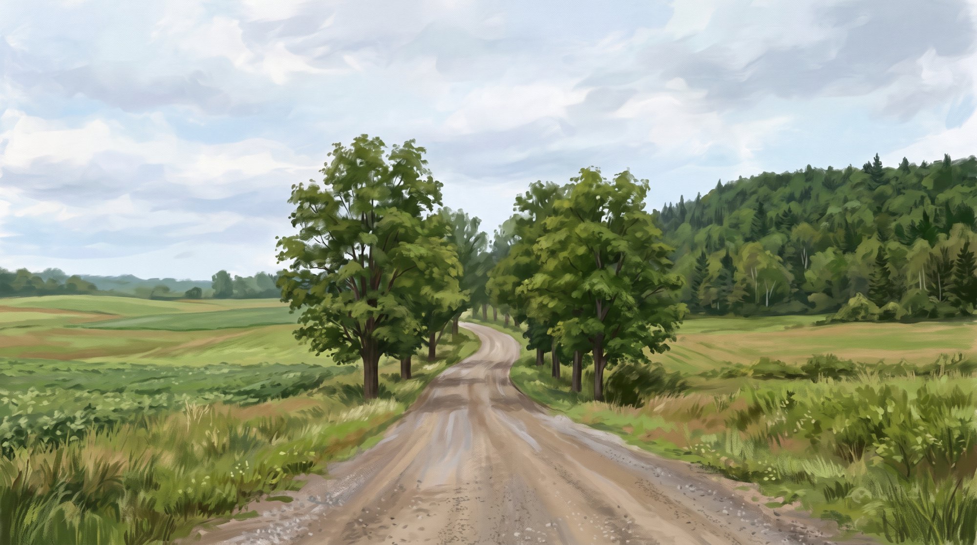
Wade, Maine is an incorporated rural town located in east-central Aroostook County. It sits directly west of Washburn and south of Perham, covering a total area of 36.37 square miles (94.20 square kilometers), of which 36.11 square miles is land and 0.26 square miles is water. The elevation of Wade is listed as 840 feet above sea level. This guide provides practical information about visiting or moving to Wade Maine.
Geography and Demographics
The town borders Perham to the north, Washburn to the east, and unorganized township lands including T13 R5 WELS and T14 R5 WELS. The Aroostook River flows across the southern portion of Wade, and Gardner Creek is a local tributary stream that feeds into it.
According to the 2020 U.S. Census, Wade had a total population of 229 residents, down 19.1% from 283 residents in 2010 (when there were 112 households). The median age was recorded at 47.4 years in 2010, while the American Community Survey 5-Year Estimates place the median age at 53.6 years as of late 2024. The median household income is estimated at $41,818, with a per capita income of $36,000, compared to the Aroostook County average of $34,879. The estimated poverty rate is 4.2%, representing approximately 10 residents. Agriculture remains the primary economic activity in Wade, with traditional regional heritage activities including farming, foraging, and botanical remedies.
Local Government and Community Services
The town shares municipal administration with the adjacent town of Washburn. Services such as municipal records, permits, tax documents, budget administration, public works coordination, and annual town reports are hosted and managed through the Washburn town office:
- Office Address: 1370 Main Street, Washburn, ME 04786
- Phone Number: 207-455-8485
- Hours: Monday through Thursday from 7:00 AM to 4:00 PM
- ZIP Code: 04786 (served via the neighboring Washburn post office)
Emergency services and public resources are coordinated with neighboring communities:
- Fire Protection: Provided by the neighboring Washburn Fire Department.
- Emergency Medical Services: Ambulance services are delivered in partnership with Northern Light AR Gould Hospital's Crown Ambulance, which maintains an ambulance base in Washburn.
- Law Enforcement: Wade does not maintain a municipal police department; coverage is provided by the Aroostook County Sheriff's Office and the Maine State Police.
- Library: Residents share public library services with the Washburn Memorial Library, located at 1290 Main Street in Washburn. The library preserves historical Wade Town Reports from 1899 to 1981 in its genealogy collection.
- Historical Organization: Wade participates alongside Washburn and Perham in the Salmon Brook Historical Society.

Schools
Wade is part of Maine School Administrative District No. 45 (MSAD #45 / RSU 45), partnering with Perham and Washburn for educational administration and shared arts programming. The school board includes elected representation from Wade, Perham, and Washburn. District facilities include:
- District Administration Office: 33 School Street, Washburn
- Elementary School: David J. Lyon Washburn Elementary School, located at 33 School Street in Washburn
- High School: Washburn District High School, located at 1359 Main Street in Washburn
Outdoor Recreation
Wade offers outdoor activities centered around its river and trail systems:
- Paddling: The Aroostook River passes through Wade as part of a 21-mile paddling route between Ashland and Washburn. A public boat launch is located in town off Gardner Creek Road.
- Fishing: The stretch of the Aroostook River in Wade features cold-water fishing, particularly for native brook trout early in the season.
- Snowmobiling and Multi-Use Trails: The Aroostook River Snowmobile Club is headquartered at 407 Richardson Road in Wade and maintains trails that connect to surrounding towns and the regional network. Wade also connects to the Aroostook Valley Trail network, linking local snowmobile and ATV routes to Washburn, Caribou, and Presque Isle.
Transportation
Among employed Wade residents, approximately 73% commute by driving alone, 15% carpool, 10% work from home, and 2% walk to work. Key local roads include Gardner Creek Road and North Wade Road. In the northeastern corner of town, Maine State Route 228 crosses along Perham Road before continuing into Perham.
Wade is located directly west of Washburn and within a short driving distance of regional centers like Caribou and Presque Isle. Additional travel options in the area include:
- Rural Bus Transit: Countywide rural demand-response bus service is administered and operated by the Aroostook Regional Transportation System (ARTS).
- Intercity Bus: Scheduled intercity buses operated by Cyr Bus Line connect nearby Caribou and Presque Isle to Bangor.
- Airport: Presque Isle International Airport (PQI) in neighboring Presque Isle offers commercial passenger airline service.

History of Wade
The area that became Wade was first settled in 1846, back when the community was known as Dunntown. It was originally organized from Township 13, Range 4 WELS in 1861.
Our community continued to grow, organizing as a plantation in 1874. Wade officially took its place as an incorporated town in 1913.
See the history facts and their sources in Quick facts below.
Quick facts
·
Population
- 2010 Decennial Census Households
- As of the 2010 census, there were 112 households living in the town of Wade.[1]
- 2010 Decennial Census Median Age
- According to the 2010 U.S. Census Summary Population and Housing Characteristics report, the median age in Wade town was 47.4 years.[2]
- 2020 Census Population
- The town of Wade had a total population of 229 as of the 2020 Decennial Census.[1]
- 2020 Decennial Census Population
- At the 2020 U.S. Census, the population of Wade was 229.[1]
- ACS Estimated Median Age
- According to the U.S. Census Bureau's American Community Survey 5-Year Estimates, the median age of Wade town was estimated at 53.6 years.[3]
- Population Change (2010–2020)
- Wade's population decreased by 19.1% between 2010 and 2020, falling from 283 residents in 2010 to 229 in 2020.[1]
History (5)
- First Settlement
- The area that became the town of Wade was first settled in 1846.[4]
- Former Name
- Before taking its present name, the community was known as Dunntown.[4]
- Incorporation
- Originally organized from Township 13, Range 4 WELS in 1861, Wade was incorporated as a town in 1913.[5]
- Plantation Organization
- Wade was organized as a plantation in 1874.[4]
- Town Incorporation
- Wade was officially incorporated as a town in 1913.[4]
Government (5)
- Town Office Address
- The municipal office serving Wade is located at 1370 Main Street, Washburn, ME 04786.[6]
- Town Office Administration
- Administrative services, municipal records, permits, and tax documents for the Town of Wade are hosted and managed through the Town of Washburn municipal office.[6]
- Town Office Hours
- The town office operating hours are Monday through Thursday from 7:00 AM to 4:00 PM.[7]
- Town Office Phone Number
- The phone number for the town office is 207-455-8485.[6]
- ZIP Code
- Wade is served by ZIP code 04786 via the neighboring Washburn post office.[8]
Schools (5)
- District Administration Office
- The superintendent's and administrative office for MSAD #45 is located at 33 School Street in Washburn.[9]
- Public Elementary School
- Elementary students residing in Wade attend David J. Lyon Washburn Elementary School, located at 33 School Street in neighboring Washburn.[9]
- Public High School
- Secondary students residing in Wade attend Washburn District High School, located at 1359 Main Street in neighboring Washburn.[9]
- School Board Representation
- The MSAD #45 School Board includes elected representation from the town of Wade alongside directors from Perham and Washburn.[10]
- School District Serving Wade
- The town of Wade is served by Maine School Administrative District No. 45 (MSAD #45 / RSU 45), which encompasses the member communities of Perham, Wade, and Washburn.[9]
Economy (6)
- Means of Commuting
- Among employed residents in Wade, approximately 73% commute by driving alone, 15% carpool, 10% work from home, and 2% walk to work.[11]
- Median Household Income
- According to U.S. Census Bureau American Community Survey 5-year estimates reported by Census Reporter, the median household income in the town of Wade is $41,818.[11]
- Municipal Administration and Budget Services
- Municipal administration, budget administration, and annual town reports for the Town of Wade are coordinated and hosted through the neighboring Town of Washburn municipal office.[6]
- Per Capita Income
- Census Reporter estimates that the per capita income in Wade is $36,000, which is slightly above the countywide Aroostook County average of $34,879.[11]
- Poverty Rate
- The estimated poverty rate in Wade is 4.2%, with approximately 10 residents living below the poverty threshold.[11]
- School District Administration
- Wade partners with neighboring communities Washburn and Perham as part of Maine School Administrative District 45 (MSAD 45) for educational services and administration.[1]
Recreation (4)
- Aroostook River Fishing
- The stretch of the Aroostook River passing through Wade features cold-water fishing, particularly for native brook trout early in the season.[12]
- Aroostook River Paddling Route
- The Aroostook River flows through Wade as part of a 21-mile paddling route between Ashland and Washburn. A public boat launch is located in Wade and accessed via Gardner Creek Road.[12]
- Aroostook River Snowmobile Club
- The Aroostook River Snowmobile Club is headquartered at 407 Richardson Road in Wade and maintains trails connecting the area with neighboring towns and the regional snowmobile network.[13]
- Aroostook Valley Trail Network
- Wade connects to the multi-use Aroostook Valley Trail network, which links local snowmobile and ATV corridors to neighboring communities including Washburn, Caribou, and Presque Isle.[14]
Culture (5)
- Public Library Services and Town Archives
- Wade residents share public library services with neighboring Washburn via the Washburn Memorial Library, which preserves historical Wade Town Reports spanning from 1899 to 1981 in its genealogy collection.[15]
- Salmon Brook Historical Society
- In 1980, citizens from Wade, Washburn, and Perham organized the Salmon Brook Historical Society to collect and preserve materials illustrating local history.[16]
- School District Arts and Education
- Wade belongs to Maine School Administrative District 45 alongside Washburn and Perham, sharing district elementary and high school educational and arts programming.[17]
- Settlement and Incorporation History
- Wade was first settled in 1846, organized as a plantation in 1874, and incorporated as a town in 1913, having previously been known as Dunntown.[4]
- Traditional Agricultural Heritage
- Agriculture remains the primary economic activity in Wade, with traditional regional heritage activities including farming, foraging, and botanical remedies.[4]
Transportation (6)
- Intercity bus connection
- Scheduled commercial intercity bus service through northern Aroostook County is operated by Cyr Bus Line, connecting communities such as nearby Caribou and Presque Isle to Bangor.[18]
- Local thoroughfares
- Key local corridors serving the town include Gardner Creek Road and North Wade Road.[19]
- Nearest commercial airport
- Presque Isle International Airport (PQI) in neighboring Presque Isle provides commercial passenger airline service for the surrounding area.[20]
- Proximity to regional centers
- Wade is located directly west of Washburn and lies within a short driving distance of the larger service centers of Presque Isle and Caribou.[21]
- Regional bus transit operator
- Public rural demand-response bus transportation across Aroostook County is administered and operated by the Aroostook Regional Transportation System (ARTS).[22]
- State highway clip
- Maine State Route 228 traverses the northeastern edge of Wade along Perham Road before continuing north into Perham.[23]
Services (5)
- Emergency medical services
- Emergency medical and ambulance services for Wade and Washburn are provided in partnership with Northern Light AR Gould Hospital's Crown Ambulance, which maintains an ambulance base in Washburn.[24]
- Fire protection services
- Fire protection for the town of Wade is provided by the neighboring Washburn Fire Department.[25]
- Law enforcement coverage
- Wade does not maintain its own municipal police department and relies on the Aroostook County Sheriff's Office and Maine State Police for law enforcement coverage.[26]
- Local public library access
- Wade residents are served by the nearby Washburn Memorial Library, located at 1290 Main Street in Washburn.[27]
- Municipal administration and public works coordination
- The town of Wade shares municipal administration with the adjacent town of Washburn, with municipal operations and records managed from the Washburn town office.[6]
Geography (8)
- Bodies of water
- The Aroostook River flows across the southern portion of the town of Wade.[28]
- Bordering communities
- Wade borders Perham to the north, Washburn to the east, and unorganized township lands including T13 R5 WELS and T14 R5 WELS.[29]
- Gardner Creek
- Gardner Creek is a tributary stream located in Wade that flows into the Aroostook River.[30]
- Land and water area
- Of Wade's total area, 36.11 square miles (93.52 square kilometers) is land and 0.26 square miles (0.67 square kilometers) is water.[1]
- Location within Aroostook County
- Wade is an incorporated rural town located in east-central Aroostook County, situated directly west of Washburn and south of Perham.[31]
- Total Area
- Wade covers a total area of 36.37 square miles, consisting of 36.11 square miles of land and 0.26 square miles of water.[1]
- Total area
- According to the U.S. Census Bureau, the town of Wade has a total area of 36.37 square miles (94.20 square kilometers).[1]
- Town elevation
- Wade has an elevation listed as 840 feet above sea level.[32]
Businesses in Wade
Map of Wade
Nearby communities
All communities in The County
St. John Valley
Central Aroostook
Southern Aroostook
Sources (32)
- Wade, Maine - Wikipedia — en.wikipedia.org , viewed Oct 11, 2026
- Maine: 2010 - IPUMS USA — ipums.org , viewed Oct 11, 2026
- S0701Geographic Mobility by Selected Characteristics in the United States - Census Data — data.census.gov , viewed Oct 11, 2026
- Wade - Undiscovered Maine — umaine.edu , viewed Oct 11, 2026
- Maine Plantations - FamilySearch — familysearch.org , viewed Oct 10, 2026
- Town of Wade - Washburn, Maine — washburnmaine.org , viewed Oct 11, 2026
- Contact the Town of Washburn | Town Offices — washburnmaine.org , viewed Oct 11, 2026
- ZIP Code 04786 Map, Demographics, More for Washburn, ME — unitedstateszipcodes.org , viewed Oct 11, 2026
- MSAD #45: Home — msad45.net , viewed Oct 11, 2026
- Regional School Units (RSUs) | Department of Education - Maine.gov — maine.gov , viewed Oct 10, 2026
- Wade town, Aroostook County, ME - Profile data - Census Reporter — censusreporter.org , viewed Oct 11, 2026
- Aroostook River Paddling Route (Ashland to Washburn) - Maine Trail Finder — files.aptuitivcdn.com , viewed Oct 11, 2026
- Maine - Aroostook County - Go Northeast Snowmobiling — irp.cdn-website.com , viewed Oct 11, 2026
- March in Presque Isle: Maine's Best Month Nobody Talks About - The Northeastland Hotel — northeastlandhotel.com , viewed Oct 11, 2026
- GENEALOGY & RESEARCH | wmlibrary - Washburn Memorial Library — washburnlibrary.com , viewed Oct 11, 2026
- Historical Society - Town of Washburn — washburnmaine.org , viewed Oct 11, 2026
- Staff - MSAD #45 — msad45.net , viewed Oct 11, 2026
- Ground Transportation | Bangor International Airport — flybangor.com , viewed Oct 11, 2026
- Aroostook River at Washburn - National Water Prediction Service — water.noaa.gov , viewed Oct 11, 2026
- Airport - Welcome to Presque Isle, ME — presqueislemaine.gov , viewed Oct 9, 2026
- Town Status Map - Maine.gov — maine.gov , viewed Oct 11, 2026
- Measures of Growth - Maine Development Foundation — mdf.org , viewed Oct 11, 2026
- Maine State Route 228 - Wikipedia — en.wikipedia.org , viewed Oct 11, 2026
- Crown Ambulance sets up station in Washburn - The County — thecounty.me , viewed Oct 11, 2026
- Fire Department | Town of Washburn, Maine | Aroostook County — washburnmaine.org , viewed Oct 11, 2026
- Washburn closes police department temporarily after chief leaves job - The County — thecounty.me , viewed Oct 11, 2026
- Washburn Memorial Libray | Washburn | Maine | Public Library — washburnlibrary.com , viewed Oct 11, 2026
- Wade - Undiscovered Maine — umaine.edu , viewed Oct 11, 2026
- Town Status Map - Maine.gov — maine.gov , viewed Oct 11, 2026
- public notice - (USACE), New England — nae.usace.army.mil , viewed Oct 11, 2026
- Legend - Maine.gov — maine.gov , viewed Oct 11, 2026
- Aroostook County Elevations - Cooperative Extension: Food & Health — extension.umaine.edu , viewed Oct 11, 2026