Merrill
A small town in Aroostook County
Weather in Merrill
Loading the forecast…
 Your logo here
This page could be sponsored
Your business name here
Sponsor This Page
Located along Route 212, Merrill is an Aroostook County town with a population of 208 at the 2020 census. Named after Captain William Merrill and incorporated in 1911, the community borders Smyrna and Moro Plantation.
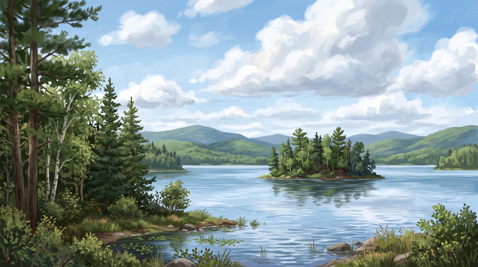
Merrill is a rural town located in Aroostook County, Maine, sitting at an elevation of 968 feet above sea level. For travelers seeking information about Merrill Maine, the town borders Smyrna directly to the east, Moro Plantation to the west, and Hersey to the south and southwest.
Community Profile
At the 2020 Decennial Census, Merrill had a population of 208 people, down from 273 in 2010 (a decline of 23.8%). The town's municipal website notes an estimated population of approximately 250. According to five-year American Community Survey estimates, the median age is 33.2 years, and there are 125 households (compared to 104 households recorded in the 2010 Census). In the 2010 Census, American Indian and Alaska Native residents comprised 4.4% of the population. ACS 5-year estimates report a median household income of approximately $56,700 and a per capita income of approximately $34,879.
Local Economy and Businesses
Farming, forestry, and trade services operate throughout Merrill. Local agricultural and forestry businesses include Delette Ridge Farm, Dale Boutilier Potato Farm, Gene & Barbara Lawlor Cattle Farm, and Chris Bates Logging. Contracting and trade businesses serving the area include Ora Hardy Construction, Bartman Towing & Upholstery, and Chris Bond Contracting Service.
Town Government and Municipal Services
Merrill operates under a Selectmen/Town Manager/Town Meeting form of government. Municipal leadership and staff include:
- Board of Selectmen and Commissioners: Thomas Goff, Mark Lawlor, and Craig McMannus.
- Town Manager, Tax Collector, Deputy Treasurer, and Clerk: Candis Nevers.
- Treasurer, Deputy Clerk, and Deputy Tax Collector: Alberta McDonald.
- Code Enforcement Officer: Bill Wright, reachable at (207) 757-8556.
- Fire Warden: Randy Rockwell, reachable at (207) 757-8343.
- Animal Control Officer: John Graham, reachable at (207) 757-8152.
Merrill does not operate an independent police department; law enforcement services are provided by the Maine State Police (Troop F) and the Aroostook County Sheriff's Office.
Education
Merrill is part of Regional School Unit No. 50 (RSU 50), which also includes Crystal, Dyer Brook, Hersey, Island Falls, Oakfield, and Smyrna. It is also affiliated with the six-town Southern Aroostook Community School District (CSD #9 / SACS). Local public school students attend Southern Aroostook Community School, a PreK–12 facility. High school students have access to vocational and technical training through Region Two Career and Technical Education programs as well as Southern Aroostook Vocational Education (SAVE). RSU 50 also provides adult education programming. For post-secondary learning, the town notes proximity to the Higher Education Center located less than a half-hour away in Houlton.
Outdoor Recreation and Local Parks
Merrill offers multiple opportunities for outdoor recreation across its forests, waterways, and trails:
- Merrill Millstream Park: Located on the East Branch of the Mattawamkeag River, this community park hosts seasonal events. In the spring, an annual canoe and kayak race has been organized starting from the park along the river. During the winter, the town maintains an outdoor ice skating rink complete with a twenty-foot decorated Christmas tree, and the park hosts an annual "Christmas in the Park" gathering for local families.
- Paddling and Fishing: The East Branch of the Mattawamkeag River and local streams provide options for canoeing, kayaking, and brook trout fishing.
- Hiking: Local hiking spots include Hastings Falls, which is used for hiking and picnicking, and nearby Sholler Mountain. Additionally, the International Appalachian Trail passes through Merrill along Townline Road, featuring a camping lean-to shelter adjacent to Roach Farm.
- Trail Riding: The town maintains a network of groomed snowmobile trails in winter and connected ATV trails in summer.
Transportation
Merrill is situated about 100 miles north of Bangor, Maine. Maine State Route 212 runs through the town, connecting State Route 11 in Moro Plantation to U.S. Route 2 in Smyrna, and passes just a couple of miles from Interstate 95. According to the Maine Department of Transportation, the town contains 18.72 miles of public roads (9.36 miles of State Highway and 9.36 miles of townways). Regional public transit across Aroostook County is administered under Maine DOT Transit Region 1 by the Aroostook Regional Transportation System (ARTS).

History of Merrill
The land here was originally designated as Township VI, Range IV (T6 R4 WELS). Around 1840, Captain William Merrill of Portland, Maine, purchased the southeast quarter of the township, giving our settlement its name. A few years later, in 1846, the northwest quarter of the township was organized as part of Rockabema Plantation.
The area was officially organized as the Plantation of Merrill on June 1, 1876. Decades later, in 1911, Merrill Plantation was officially incorporated as the town of Merrill.
See the history facts and their sources in Quick facts below.
Quick facts
·
Population
- 2010 Census Households
- According to the 2010 U.S. Census, Merrill had 104 households.[1]
- 2010 to 2020 Population Change
- Merrill's population decreased from 273 in 2010 to 208 in 2020, representing a decline of 23.8%.[1]
- 2020 Census Population
- Merrill had a total population of 208 at the 2020 Decennial Census.[1]
- 2020 Census Population
- At the 2020 Decennial Census, the population of Merrill was 208.[1]
- Estimated Median Age
- According to five-year American Community Survey estimates reported by Census Reporter, the median age in Merrill is 33.2 years.[2]
- Estimated Number of Households
- Five-year American Community Survey estimates reported by Census Reporter record 125 households in Merrill.[2]
- Town Estimate of Population
- The official municipal website for the town states that Merrill has a human population of approximately 250.[3]
History (5)
- Early Organization as Rockabema Plantation
- Before its reorganization, the northwest quarter of the township was organized in 1846 as part of Rockabema Plantation.[4]
- Incorporation
- The town of Merrill was incorporated in 1911 from the earlier Merrill Plantation.[5]
- Town Incorporation
- Merrill Plantation was officially incorporated as the town of Merrill in 1911.[6]
- Town Name Origin and Early Land Purchase
- The settlement was named for Captain William Merrill of Portland, Maine, who purchased the southeast quarter of the township around 1840.[7]
- Township Designation and Plantation Organization
- The area comprising Merrill was originally designated as Township VI, Range IV (T6 R4 WELS) and was officially organized as the Plantation of Merrill on June 1, 1876.[6]
Government (8)
- Animal Control Officer
- John Graham serves as Animal Control Officer and can be reached by phone at (207) 757-8152.[8]
- Board of Selectmen
- The Board of Selectmen and Commissioners includes Thomas Goff, Mark Lawlor, and Craig Mcmannus.[8]
- Code Enforcement Officer
- Bill Wright serves as Code Enforcement Officer and can be reached by phone at (207) 757-8556.[8]
- Fire Warden
- Randy Rockwell serves as Fire Warden and can be reached by phone at (207) 757-8343.[8]
- Form of Government
- The town of Merrill operates under a Selectmen/Town Manager/Town Meeting form of government.[3]
- Form of Government
- Merrill operates under a Selectmen/Town Manager/Town Meeting form of government.[3]
- Town Manager
- Candis Nevers serves as the Town Manager, Tax Collector, Deputy Treasurer, and Clerk.[8]
- Treasurer
- Alberta McDonald serves as Treasurer, Deputy Clerk, and Deputy Tax Collector.[8]
Schools (5)
- Adult Education Programs
- RSU 50 provides adult education programming in addition to its PreK–12 offerings.[9]
- Career and Technical Education Access
- Students attending Southern Aroostook Community School have access to vocational and technical training through Region Two Career and Technical Education programs.[9]
- Higher Education Proximity
- The Town of Merrill notes proximity to the Higher Education Center located less than a half-hour away in Houlton.[10]
- Public School Facility
- Public school students in Merrill attend Southern Aroostook Community School, a comprehensive PreK–12 school serving RSU 50.[9]
- School District Membership
- Merrill is a member community of Regional School Unit No. 50 (RSU 50), which also serves Crystal, Dyer Brook, Hersey, Island Falls, Oakfield, and Smyrna.[9]
Economy (6)
- Historic Economic Drivers
- Lumbering was an early primary driver of Merrill's economy, with logs driven down rivers, alongside farming and potato cultivation that supported local commerce into the 20th century.[11]
- Local Agriculture and Forestry Businesses
- Commercial enterprises operating within Merrill include agricultural and forestry establishments such as Delette Ridge Farm, Dale Boutilier Potato Farm, Gene & Barbara Lawlor Cattle Farm, and Chris Bates Logging.[12]
- Local Trades and Construction Services
- Local trade and contracting businesses in Merrill include Ora Hardy Construction, Bartman Towing & Upholstery, and Chris Bond Contracting Service.[12]
- Median Household Income
- According to the U.S. Census Bureau American Community Survey 5-year estimates reported by Census Reporter, the median household income in Merrill is approximately $56,700.[13]
- Per Capita Income
- The per capita income in Merrill is estimated at approximately $34,879 based on U.S. Census Bureau American Community Survey 5-year data.[13]
- School District Affiliation
- Merrill is part of the six-town Southern Aroostook Community School District (CSD #9 / SACS), which provides education and vocational training through Southern Aroostook Vocational Education (SAVE).[14]
Landmarks (2)
- Captain Merrill Barn Hinges
- The hinges on Captain William Merrill's large barn were salvaged from the British brig Boxer, which was captured off Portland during the War of 1812.[15]
- Captain William Merrill Homestead
- The town's original homestead was built in 1844 by town namesake Captain William Merrill and has been continuously occupied since its construction.[15]
Recreation (6)
- Hastings Falls
- Hastings Falls in Merrill is a local outdoor destination utilized for hiking and picnicking.[16]
- International Appalachian Trail
- The International Appalachian Trail passes through Merrill along Townline Road, with a camping lean-to shelter located adjacent to Roach Farm.[5]
- Merrill Millstream Park
- Merrill Millstream Park is situated on the shores of the East Branch of the Mattawamkeag River in Merrill.[16]
- River Paddling and Fishing
- Local rivers and streams including the East Branch of the Mattawamkeag River offer opportunities for canoeing, kayaking, and brook trout fishing.[17]
- Sholler Mountain Hiking
- Sholler Mountain is an outdoor hiking destination accessible in the Merrill area.[16]
- Snowmobile and ATV Trail Networks
- Merrill maintains a network of groomed snowmobile trails in winter and interconnected ATV trails during summer, making it a regular stopping point for trail riders.[5]
Events (3)
- Annual Canoe and Kayak Race
- The Merrill Millstream Park Committee organized an annual spring canoe and kayak race along the East Branch of the Mattawamkeag River starting from Merrill Millstream Park.[18]
- Christmas in the Park
- An annual community holiday gathering called 'Christmas in the Park' is held for local children and families at Merrill Millstream Park.[19]
- Winter Ice Skating at Millstream Park
- During winter months, the Town of Merrill maintains an outdoor skating rink with a twenty-foot decorated Christmas tree at Merrill Millstream Park.[20]
Culture (3)
- Agricultural Heritage
- Early farming prosperity in Merrill expanded after 1894 when the railroad arrived in neighboring Smyrna, enabling local farmers to ship potatoes and supply regional potato starch factories.[21]
- Native American Population
- According to the 2010 U.S. Census, American Indian and Alaska Native residents comprised 4.4% of the population of the town of Merrill.[1]
- Town Namesake and Historical Heritage
- The town of Merrill was named for Captain William Merrill, an early owner and resident of the township, before its incorporation in 1911. Early settlers developed the community's economy and built stately farm homesteads centered on farming and lumbering.[22]
Transportation (5)
- Distance to Bangor
- Merrill is situated approximately 100 miles north of the city of Bangor, Maine.[3]
- Primary Highway Route
- Maine State Route 212 runs through the town of Merrill, connecting State Route 11 in Moro Plantation to U.S. Route 2 in Smyrna.[23]
- Proximity to Interstate 95
- According to the town administration, Merrill is located along Route 212 and is situated just a couple of miles from Interstate 95.[3]
- Public Road Mileage
- According to the Maine Department of Transportation, Merrill contains 9.36 miles of State Highway and 9.36 miles of townways, totaling 18.72 miles of public roads.[24]
- Regional Public Transit Provider
- Public transit services in Merrill and throughout Aroostook County are administered under Maine DOT Transit Region 1 by Aroostook Regional Transportation System (ARTS).[25]
Services (6)
- Animal Control Officer
- Animal control enforcement in Merrill is handled by Animal Control Officer John Graham.[26]
- Code Enforcement
- Local code compliance and enforcement services for Merrill are managed by Code Enforcement Officer Bill Wright.[26]
- Police Coverage
- Merrill does not maintain an independent municipal police department; law enforcement calls in the town are investigated by the Maine State Police (Troop F) and the Aroostook County Sheriff's Office.[27]
- Selectmen and Commissioners
- The municipal administration of Merrill includes elected Selectmen and Commissioners Thomas Goff, Mark Lawlor, and Craig McMannus.[26]
- Town Administration
- Daily municipal management and records administration are directed by Town Manager, Tax Collector, Deputy Treasurer, and Clerk Candis Nevers.[26]
- Town Fire Warden
- The Town of Merrill maintains a local Fire Warden position, held by Randy Rockwell.[26]
Geography (8)
- Bordering community of Hersey
- The town of Hersey borders the Merrill area along its southern/southwestern boundary.[28]
- Bordering community of Moro Plantation
- Moro Plantation lies to the west of the town of Merrill.[29]
- Bordering community of Smyrna
- The town of Smyrna is situated directly east of Merrill.[28]
- Elevation
- Merrill has an elevation of 968 feet above sea level.[30]
- Location within Aroostook County
- The town of Merrill is situated in southern Aroostook County along Route 2, just a few miles from Interstate 95.[3]
- Postal Code
- Merrill is served by ZIP code 04780.[31]
- Total Area
- The town of Merrill covers a total area of 37.38 square miles, consisting of 37.35 square miles of land and 0.03 square miles of water.[1]
- Total land and water area
- Merrill covers an area of roughly six miles square, comprising about 37.38 square miles in total, of which 37.35 square miles is land and 0.03 square miles is water.[1]
Businesses in Merrill
Map of Merrill
Nearby communities
All communities in The County
St. John Valley
Central Aroostook
Southern Aroostook
Sources (31)
- Merrill, Maine - Wikipedia — en.wikipedia.org , viewed Oct 10, 2026
- Merrill town, Aroostook County, ME - Profile data - Census Reporter — censusreporter.org , viewed Oct 10, 2026
- The Town Merrill Maine - Aroostook County — merrill.aroostook.me.us , viewed Oct 10, 2026
- Merrill, Aroostook County, Maine Genealogy - FamilySearch — familysearch.org , viewed Oct 10, 2026
- Merrill - Undiscovered Maine — umaine.edu , viewed Oct 10, 2026
- Education & History - The Town Merrill Maine — merrill.aroostook.me.us , viewed Oct 10, 2026
- Town Histories of Aroostook County Maine - Genealogy Trails — genealogytrails.com , viewed Oct 10, 2026
- Contact Us - The Town Merrill Maine — merrill.aroostook.me.us , viewed Oct 10, 2026
- WELCOME - RSU 50 — rsu50.org , viewed Oct 10, 2026
- Education & History - The Town Merrill Maine — merrill.aroostook.me.us , viewed Oct 10, 2026
- History - The Town Merrill Maine — merrill.aroostook.me.us , viewed Oct 10, 2026
- Businesses - The Town Merrill Maine — merrill.aroostook.me.us , viewed Oct 10, 2026
- Merrill town, Aroostook County, ME - Profile data - Census Reporter — censusreporter.org , viewed Oct 10, 2026
- Education & History - The Town Merrill Maine — merrill.aroostook.me.us , viewed Oct 10, 2026
- Education & History - The Town Merrill Maine — merrill.aroostook.me.us , viewed Oct 10, 2026
- Attractions - The Town Merrill Maine — merrill.aroostook.me.us , viewed Oct 10, 2026
- Hunting & Fishing - The Town Merrill Maine — merrill.aroostook.me.us , viewed Oct 10, 2026
- On Deck sports calendar for April 25, 2013 - Bangor Daily News — bangordailynews.com , viewed Oct 10, 2026
- Oakfield community holds memorial event for couple slain nearly a year ago — bangordailynews.com , viewed Oct 10, 2026
- Merrill Millstream Park — merrill.aroostook.me.us , viewed Oct 10, 2026
- Education & History - The Town Merrill Maine — merrill.aroostook.me.us , viewed Oct 10, 2026
- Merrill - Undiscovered Maine — umaine.edu , viewed Oct 10, 2026
- Maine State Route 212 - Wikipedia — en.wikipedia.org , viewed Oct 10, 2026
- Aroostook County Public Road Centerline* mileage by Municipality as of 1/1/17 Town name Inter-state State Highway State Aid High - Maine.gov — maine.gov , viewed Oct 10, 2026
- Public Transit Services in Maine | Maine Department of Transportation - Maine.gov — maine.gov , viewed Oct 10, 2026
- Contact Us - The Town Merrill Maine — merrill.aroostook.me.us , viewed Oct 10, 2026
- Maine State Police Troop F Weekly Report (Jan. 2 – 8) — wagmtv.com , viewed Oct 10, 2026
- Town Status Map - Maine.gov — maine.gov , viewed Oct 10, 2026
- Moro, Aroostook County, Maine Genealogy - FamilySearch — familysearch.org , viewed Oct 10, 2026
- Aroostook County Elevations - Cooperative Extension: Food & Health — extension.umaine.edu , viewed Oct 10, 2026
- Merrill, Maine ZIP Code - United States — me.postcodebase.com , viewed Oct 10, 2026

