Chapman
A rural community in Aroostook County
Weather in Chapman
Loading the forecast…
 Your logo here
This page could be sponsored
Your business name here
Sponsor This Page
Originally designated Township 11, Range 3, Chapman was organized as a plantation in 1874 and incorporated as a town in 1915. Today, the community of 491 residents shares municipal administration, highway services, and recreation with neighboring Mapleton and Castle Hill. Its landscape includes waterways like Alder Lake and Presque Isle Stream, alongside local trails maintained by the Chapman Ridge Runners Snowmobile Club.

Chapman is a rural municipality in central Aroostook County, Maine, situated at an elevation of 515 feet. For anyone researching Chapman Maine, the town is zoned entirely for residential, agricultural, and forest uses, with local waterways including Alder Lake, Alder Brook, and Presque Isle Stream.
Community and Demographics
In the 2020 Decennial Census, Chapman recorded a total population of 491 residents. That reflects a 4.9 percent increase from 2010, when the population was 468 across 194 households, with 59.3 percent being married couples living together. The median age in Chapman was 42.4 years in 2010, up from 38 years in 2000, when 465 people lived in 177 households.
Town Government and Public Services
Chapman shares municipal administration, highway services, fire protection, and administrative staff with the neighboring towns of Mapleton and Castle Hill under a formal interlocal agreement established in 1992 and renewed for 15 years in 2024. The joint town office is located at 103 Pulcifur Road, PO Box 500, Mapleton, ME 04757, and is open Monday through Friday from 8:00 AM to 4:00 PM. The joint office telephone and fax number is (207) 764-3754, and Chapman shares the ZIP code 04757.
Key municipal contacts and officials include:
- Town Manager: Sandra L. Fournier
- Town Clerk: Samantha Watt
- Select Board: Isaac Braley, Milford (Mickey) Maynard, Patricia Sutherland, Charles Beaulieu II, and Terrence Hanlon, who meet on the second Wednesday of the month at 4:00 PM
- Fire Department: The joint Mapleton, Castle Hill, and Chapman Volunteer Fire Department is led by Fire Chief Adam Rider.
- Highway Department: Road Commissioner Christopher Woodworth oversees the shared Joint Highway Department, which manages approximately 60 to 70 miles of public roads across the three communities.
- Law Enforcement: Chapman does not have its own police department; emergency dispatch services are handled through the County Sheriff's Department.
Chapman, Mapleton, and Castle Hill also adopted a joint three-town comprehensive plan in March 2013 to coordinate land use, economic planning, natural resources, and infrastructure.
Local Roads
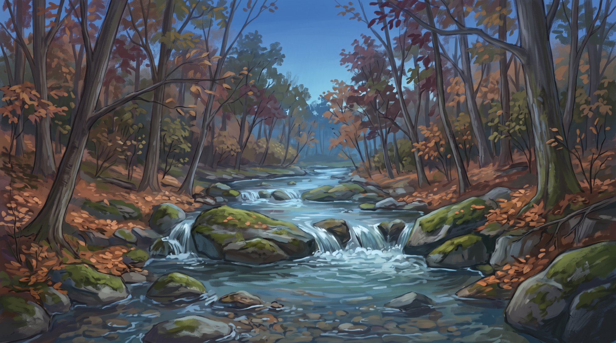
Chapman's local road network includes Chapman Road, West Chapman Road, Town Hall Road, and Grendell Road. Because Chapman is zoned for residential, farm, and forest uses, it does not have public school or library buildings, relying on nearby towns like Mapleton and Presque Isle for these facilities.
Education
Chapman belongs to Maine School Administrative District #1 (MSAD 1 / RSU 79) along with Castle Hill, Mapleton, Presque Isle, and Westfield. Educational facilities serving Chapman students include:
- Elementary Schools: Mapleton Elementary School, Pine Street Elementary School, and Skyway Elementary School
- Middle School: Presque Isle Middle School (grades 7 and 8)
- High School: Presque Isle High School (grades 9 through 12)
- Career and Technical Training: Presque Isle Regional Career and Technical Center (Presque Isle Tech Center), located at 79 Blake Street in Presque Isle
- Continuing Education: An adult education program operated by MSAD 1
Recreation, Community Events, and Landmarks
Chapman offers outdoor recreational opportunities across its woods, trails, and waterways:
- Snowmobiling: The Chapman Ridge Runners Snowmobile Club, based at 94 Town Hall Road, grooms and maintains 42 miles of local snowmobile trails connecting to neighboring towns and Maine's statewide Interconnected Trail System.
- Hiking: Access to the trailhead for the 3.5-mile Scopan Mountain Trail loop in Scopan Public Land is found by traveling south from town along West Chapman Road.
- Angling: Presque Isle Stream and its North Branch flow through Chapman, offering cold-water river habitat and fishing.
- Tri-Town Recreation: Chapman shares a recreation department with Mapleton and Castle Hill, organizing activities such as a summer Little League baseball program for children ages 8 to 12.
- Community Events: Residents join in Mapleton Daze, an annual multi-day summer festival with a parade, fireworks, and family activities. The Haystack Historical Society also hosts an annual baked ham dinner each September to support its Old Mill School Museum, which preserves local history for Chapman, Mapleton, and Castle Hill.
- Local Landmark: Beaulieu's Mill was established in Chapman in 1960.
History of Chapman
Originally designated Township 11, Range 3, Chapman drew its name from Cyrus Chapman, a surveyor who marked the town's four corner posts with his full name. The earliest settlers arrived in the 1860s and early 1870s, bearing family names such as Grendell, Swanback, Gardiner, Pendexter, Foss, Judkins, Fillmore, and York. Among them, German-born John Swanback and an army officer cleared land at the end of what is now West Chapman Road, creating an area that became known as Swanback. Soon after, Chapman Plantation was organized in 1874.
Growth continued into the following decades. In 1895, Chapman constructed three schoolhouses with a $1,000 budget, naming them the Mark Grendell, Hillside, and Pendexter schools. During the early 1900s, local men alongside Italian laborers built railroad beds and laid tracks connecting Chapman Siding to Squapan. Finally, Chapman was incorporated as a town on March 11, 1915.
See the history facts and their sources in Quick facts below.
Quick facts
·
Population
- 2000 Census Median Age
- The median age in Chapman was 38 years as of the 2000 census.[1]
- 2000 Census Population and Households
- At the 2000 census, Chapman had a population of 465 living across 177 households.[1]
- 2010 Census Households
- At the 2010 census, Chapman had 194 households, 59.3 percent of which were married couples living together.[1]
- 2010 Census Median Age
- The median age of Chapman residents was 42.4 years according to the 2010 Decennial Census.[1]
- 2020 Census Population
- The town of Chapman recorded a total population of 491 residents in the 2020 Decennial Census.[1]
- 2020 Population
- The town of Chapman had a population of 491 as of the 2020 Decennial Census.[1]
- Population Change (2010 to 2020)
- Between the 2010 and 2020 censuses, Chapman's population grew by 4.9 percent, increasing from 468 to 491 residents.[1]
History (8)
- Early schoolhouses construction
- In 1895, Chapman constructed three schoolhouses with a $1,000 budget, naming them the Mark Grendell, Hillside, and Pendexter schools.[2]
- Early settlers
- The earliest settlers arrived in the 1860s and early 1870s, bearing family names such as Grendell, Swanback, Gardiner, Pendexter, Foss, Judkins, Fillmore, and York.[2]
- Incorporation Date
- Chapman was organized as a plantation in 1874 and incorporated as a town on March 11, 1915.[3]
- Original designation and name origin
- Chapman was originally designated Township 11, Range 3, and was named after Cyrus Chapman, a surveyor who marked the town's four corner posts with his full name.[2]
- Plantation organization date
- Chapman Plantation was organized in 1874.[2]
- Railroad track construction
- During the early 1900s, local men alongside Italian laborers built railroad beds and laid tracks connecting Chapman Siding to Squapan.[2]
- Settlement of Swanback area
- German-born John Swanback and an army officer cleared land at the end of what is now West Chapman Road, an area that became known as Swanback.[2]
- Town incorporation date
- Chapman was incorporated as a town on March 11, 1915.[2]
Government (8)
- Interlocal Administration and Municipal Office Address
- Chapman shares municipal administration with Mapleton and Castle Hill, with the joint town office located at 103 Pulcifur Road, PO Box 500, Mapleton, ME 04757.[4]
- Select Board
- The Chapman Select Board consists of Isaac Braley, Milford (Mickey) Maynard, Patricia Sutherland, Charles Beaulieu II, and Terrence Hanlon.[4]
- Select Board Meetings
- The Chapman Select Board meets on the second Wednesday of the month at 4:00 PM.[4]
- Town Clerk
- The Town Clerk serving the municipality is Samantha Watt.[5]
- Town Manager
- The Town Manager serving the tri-town administration is Sandra L. Fournier.[6]
- Town Office Hours
- The office hours are Monday through Friday from 8:00 AM to 4:00 PM.[5]
- Town Office Phone Number
- The joint town office telephone and fax number is (207) 764-3754.[4]
- ZIP Code
- Chapman is served by ZIP code 04757.[1]
Schools (6)
- Adult Education and Training
- MSAD 1 operates an Adult Education program providing continuing education and training options for district residents.[7]
- Career and Technical Education
- The district provides career and technical training through the Presque Isle Regional Career and Technical Center (Presque Isle Tech Center), located at 79 Blake Street in Presque Isle.[8]
- Elementary Schools Serving the District
- Elementary education in MSAD 1 is provided through schools including Mapleton Elementary School, Pine Street Elementary School, and Skyway Elementary School.[7]
- Public High School
- High school students from Chapman attend Presque Isle High School, which serves grades 9 through 12 in MSAD 1.[7]
- Public Middle School
- Middle school students in MSAD 1 attend Presque Isle Middle School, which serves grades 7 and 8.[7]
- School District Membership
- Chapman is a member municipality of Maine School Administrative District #1 (MSAD 1 / RSU 79), along with Castle Hill, Mapleton, Presque Isle, and Westfield.[7]
Economy (4)
- Adoption of 15-year interlocal renewal
- The Towns of Mapleton, Castle Hill, and Chapman adopted an updated 15-year renewal of their shared interlocal agreement in 2024 to pool municipal administrative and highway functions.[9]
- Joint comprehensive planning
- Chapman, Mapleton, and Castle Hill jointly adopted Maine's first three-town comprehensive plan in March 2013 to coordinate land use, economic planning, and natural resource management.[10]
- Joint Highway Department operations
- The towns of Mapleton, Castle Hill, and Chapman have maintained a shared Joint Highway Department since 1992, cooperatively managing approximately 60 to 70 miles of public roads across the three communities.[11]
- Shared municipal administration and services
- Chapman shares administrative staff, a town manager, highway services, and general expenses with the neighboring towns of Mapleton and Castle Hill through a formal Interlocal Agreement.[9]
Landmarks (3)
- Beaulieu's Mill
- Beaulieu's Mill was established in Chapman in 1960.[12]
- Closure of Local Schoolhouses
- Voters in Chapman chose to close their local town schoolhouses during 1946–1947 when the community joined a consolidated school district.[12]
- Haystack Historical Society Old Mill School Museum
- The Old Mill School Museum, operated by the Haystack Historical Society, serves the tri-town area of Chapman, Mapleton, and Castle Hill as a repository and museum of local history and culture.[13]
Recreation (5)
- Chapman Ridge Runners Snowmobile Club
- The Chapman Ridge Runners Snowmobile Club, based at 94 Town Hall Road in Chapman, maintains local snowmobile trails connecting the town to neighboring communities and Maine's statewide Interconnected Trail System.[14]
- Joint Municipal Recreation Department
- The Town of Chapman shares a combined recreation department and municipal administration with the neighboring towns of Mapleton and Castle Hill, coordinating local youth and community sports leagues such as Little League.[15]
- Presque Isle Stream Angling and Waterways
- Presque Isle Stream and its North Branch flow through Chapman, offering cold-water river habitat and recreational angling opportunities.[16]
- Scopan Mountain Trail Access
- The trailhead for the 3.5-mile Scopan Mountain Trail loop in Scopan Public Land is accessed via West Chapman Road traveling south from Chapman.[17]
- Snowmobile Trail Grooming
- The volunteer-run Chapman Ridge Runners Snowmobile Club actively grooms and maintains 42 miles of trails in Central Aroostook County.[18]
Events (3)
- Haystack Historical Society Annual Baked Ham Dinner
- The Haystack Historical Society hosts an annual baked ham dinner each September to support its museum, serving as a longstanding tradition for residents of Mapleton, Chapman, and Castle Hill.[19]
- Mapleton Daze Festival Participation
- Residents of Chapman participate in Mapleton Daze, an annual multi-day summer community festival shared across the tri-town area of Mapleton, Castle Hill, and Chapman featuring a parade, fireworks, and family activities.[20]
- Tri-Town Little League Summer Program
- The joint Mapleton, Castle Hill, and Chapman Recreation Department organizes an annual summer Little League baseball program for children ages 8 to 12.[15]
Culture (6)
- Centennial celebration
- Chapman commemorated the 100th anniversary of its incorporation in 2015 with a town-wide Centennial Celebration that drew nearly a quarter of its population.[21]
- Early schoolhouses
- In 1895, Chapman allocated $1,000 to construct three schoolhouses: the Mark Grendell, Hillside, and Pendexter schools.[22]
- Early settlement and Swanback area
- Settlers first arrived in the 1860s and early 1870s; an area at the end of West Chapman Road was cleared by German-born John Swanback and became known locally as Swanback.[22]
- Library and institutional facilities zoning
- Chapman is zoned entirely for residential, agricultural, and forest uses and does not contain public library or school buildings, relying on nearby hubs such as Presque Isle and Mapleton for services.[23]
- Railroad construction history
- In the early 1900s, tracks linking Chapman Siding to Squapan were laid with the assistance of Italian laborers under foreman Orick Pettingale.[22]
- Town naming origin
- Chapman was originally designated Township 11, Range 3, and was named after surveyor Cyrus Chapman, who inscribed his full name on the township's four corner boundary posts.[22]
Transportation (3)
- Local Roadways
- Chapman's local road network includes Chapman Road, West Chapman Road, Town Hall Road, and Grendell Road.[24]
- Municipal Office Location
- The town of Chapman shares administrative services and municipal offices with Mapleton and Castle Hill, located at 103 Pulcifur Road in Mapleton, Maine.[25]
- Shared Regional Planning
- Chapman adopted a joint three-town comprehensive plan with neighboring Mapleton and Castle Hill in 2013 to coordinate municipal infrastructure and governance.[21]
Services (4)
- Emergency Law Enforcement Contact
- Chapman does not operate its own municipal police department; emergency and after-hours emergency dispatch services are coordinated through the County Sheriff's Department.[26]
- Fire Department
- Fire protection for Chapman is provided by the joint Mapleton, Castle Hill, and Chapman Volunteer Fire Department, led by Fire Chief Adam Rider.[27]
- Highway Department
- Chapman shares a joint Highway Department with Mapleton and Castle Hill, overseen by Road Commissioner Christopher Woodworth.[28]
- Interlocal Municipal Cooperation
- Under a formal interlocal cooperation agreement dating back to 1992, Chapman shares its highway department, fire protection, town office, and administration with the neighboring towns of Mapleton and Castle Hill.[9]
Geography (8)
- Bodies of water
- Local water bodies in Chapman include Alder Lake, Alder Brook, and Presque Isle Stream.[29]
- Bordering and neighboring communities
- Chapman forms part of a shared school administrative district and regional cluster alongside neighboring communities Mapleton, Castle Hill, Presque Isle, and Westfield.[30]
- Elevation
- The University of Maine Cooperative Extension lists the elevation of Chapman as 515 feet.[31]
- Land area
- Chapman contains 38.40 square miles (99.46 square kilometers) of land area.[1]
- Location within Aroostook County
- Chapman is an incorporated town located in central Aroostook County, Maine.[14]
- Total Area
- Chapman has a total area of 38.82 square miles, consisting of 38.40 square miles of land and 0.42 square miles of water.[1]
- Total area
- The town has a total area of 38.82 square miles (100.54 square kilometers), according to the United States Census Bureau.[1]
- Water area
- Water bodies account for 0.42 square miles (1.09 square kilometers) of Chapman's area.[1]
Businesses in Chapman
Map of Chapman
Nearby communities
All communities in The County
St. John Valley
Central Aroostook
Southern Aroostook
Sources (31)
- Chapman, Maine - Wikipedia — en.wikipedia.org , viewed Oct 10, 2026
- Chapman - Central Aroostook Chamber of Commerce — vertexaisearch.cloud.google.com , viewed Oct 10, 2026
- Chapman - Central Aroostook Chamber of Commerce — centralaroostookchamber.com , viewed Oct 10, 2026
- TOWNS OF MAPLETON, CASTLE HILL, AND CHAPMAN — mapletonmaine.gov , viewed Oct 10, 2026
- Municipal Clerks - TOWNS OF MAPLETON, CASTLE HILL, AND CHAPMAN — mapletonmaine.gov , viewed Oct 10, 2026
- Administration - TOWNS OF MAPLETON, CASTLE HILL, AND CHAPMAN — mapletonmaine.gov , viewed Oct 10, 2026
- Home | Maine School Administrative District #1 — sad1.org , viewed Oct 9, 2026
- Career and Technical Education Schools | Department of Education - Maine.gov — maine.gov , viewed Oct 9, 2026
- Interlocal Cooperation - TOWNS OF MAPLETON, CASTLE HILL, AND CHAPMAN — mapletonmaine.gov , viewed Oct 10, 2026
- Joint Comprehensive Plan - TOWNS OF MAPLETON, CASTLE HILL, AND CHAPMAN — mapletonmaine.gov , viewed Oct 10, 2026
- Comprehensive Planning: - Maine.gov — maine.gov , viewed Oct 10, 2026
- Chapman - Central Aroostook Chamber of Commerce — centralaroostookchamber.com , viewed Oct 10, 2026
- Museum gets heat pump grant - The County — thecounty.me , viewed Oct 10, 2026
- Chapman - Undiscovered Maine — umaine.edu , viewed Oct 10, 2026
- Recreation Department - TOWNS OF MAPLETON, CASTLE HILL, AND CHAPMAN — mapletonmaine.gov , viewed Oct 10, 2026
- Presque Isle Stream Fishing in Maine - Fishing Maps & Reports - onWater Fish — onwaterfish.com , viewed Oct 10, 2026
- Scopan Mountain Trail - Maine Trail Finder — mainetrailfinder.com , viewed Oct 10, 2026
- Snowmobile club celebrates successful collaboration - The County — thecounty.me , viewed Oct 10, 2026
- New fall events in Mapleton - The County — thecounty.me , viewed Oct 10, 2026
- Annual Mapleton Daze draws crowds for music, food and fun - The County — thecounty.me , viewed Oct 10, 2026
- Annual Town Report - TOWNS OF MAPLETON, CASTLE HILL, AND CHAPMAN — mapletonmaine.gov , viewed Oct 10, 2026
- Chapman - Central Aroostook Chamber of Commerce — centralaroostookchamber.com , viewed Oct 10, 2026
- Northern Maine town lifts ban on schools, hospitals and libraries - Bangor Daily News — bangordailynews.com , viewed Oct 10, 2026
- Map of Chapman, Maine in 2026 - KNOWOL — knowol.com , viewed Oct 10, 2026
- Tax Maps - TOWNS OF MAPLETON, CASTLE HILL, AND CHAPMAN — mapletonmaine.gov , viewed Oct 10, 2026
- General Assistance - TOWNS OF MAPLETON, CASTLE HILL, AND CHAPMAN — mapletonmaine.gov , viewed Oct 10, 2026
- Volunteer Fire Department - TOWNS OF MAPLETON, CASTLE HILL, AND CHAPMAN — mapletonmaine.gov , viewed Oct 10, 2026
- Highway Department - TOWNS OF MAPLETON, CASTLE HILL, AND CHAPMAN — mapletonmaine.gov , viewed Oct 10, 2026
- Map and Download GPS Waypoints for 3432 Lakes in Maine - ExpertGPS — expertgps.com , viewed Oct 10, 2026
- About Us | Zippel Elementary School - MSAD #1 — zes.msad1.org , viewed Oct 10, 2026
- Aroostook County Elevations - Cooperative Extension: Food & Health — extension.umaine.edu , viewed Oct 10, 2026