Scenic Drives
Where U.S. Route 1 Begins
Scenic drives in Aroostook County follow designated byways past rolling hills, expansive lakes, and storied border communities. Routes trace cultural heritage corridors along the Saint John River, deep forests along Route 11, and panoramic ridges along U.S. Route 1.
 Your logo here
This page could be sponsored
Your business name here
Sponsor This Page
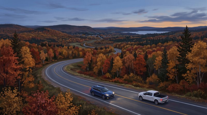
Taking scenic drives in Aroostook County begins naturally along the northern rim, where the combined 134-mile St. John Valley Cultural Byway and Fish River Scenic Byway received official National Scenic Byway designation from the Federal Highway Administration in 2021. The cultural corridor follows the Saint John River borderlands between Hamlin and Dickey in Allagash along U.S. Route 1 and State Route 161, passing traditional Acadian architectural landmarks, historic church steeples, and pastoral farmland along the Canadian border. Key roadside stops include the historic Acadian Village in Van Buren, the Musée culturel du Mont-Carmel in Lille, Four Corners Park and the Acadian Landing Site in Madawaska, and the historic Fort Kent Blockhouse.
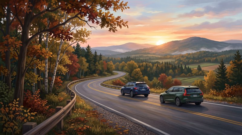

Where to go: St. John Valley · Central Aroostook · Southern Aroostook · North Woods
Rules, seasons, permits, water levels and weather change. Before you go, check current conditions and requirements with the agency that manages the place you plan to visit.
The facts behind this guide
·
Towns along the way (8)
- Fort Kent on the St. John Valley/Fish River National Scenic Byway Fort Kent
- Fort Kent marks the northern starting point of US Route 1 ('America's First Mile') and serves as an anchor community on the St. John Valley/Fish River National Scenic Byway, featuring the historic Fort Kent Blockhouse and Acadian cultural heritage.[1]
- Madawaska on the St. John Valley Cultural Byway Madawaska
- Madawaska is situated along the St. John Valley/Fish River National Scenic Byway on US Route 1, known as a cultural center of Maine's French-Acadian heritage and home to Four Corners Park.[1]
- Orient along the Million Dollar View Scenic Byway Orient
- Orient marks the northern end of the 7.9-mile Million Dollar View Scenic Byway along US Route 1 in southeastern Aroostook County, renowned for roadside turnouts looking out toward East Grand Lake and western New Brunswick.[2]
- Patten along the Katahdin Woods & Waters Scenic Byway Patten
- Patten is situated along the Katahdin Woods & Waters National Scenic Byway on Route 11 in southern Aroostook County, known for the Patten Lumbermen's Museum and panoramic roadside vistas of Mount Katahdin from Ash Hill.[3]
- Portage Lake on the Fish River Scenic Byway Portage Lake
- Portage Lake marks the southern terminus of the Fish River Scenic Byway segment on State Route 11, known for rolling hills, meadows, and wilderness lake camps.[4]
- Sherman on the Katahdin Woods & Waters Byway Corridor Sherman
- Sherman serves as an Aroostook County gateway community on the Katahdin Woods & Waters National Scenic Byway along Route 11, providing road access toward the northern entrance of Baxter State Park.[1]
- Van Buren along the St. John Valley Scenic Route Van Buren
- Van Buren serves as an eastern gateway along the St. John Valley/Fish River National Scenic Byway, recognized for its Acadian culture and historic Acadian Village.[5]
- Weston along the Million Dollar View Scenic Byway Weston
- The town of Weston lies along the Million Dollar View Scenic Byway on US Route 1, known for roadside panoramic views across the Chiputneticook Chain of Lakes to the east and Mount Katahdin to the west.[1]
Culture (3)
- Fish River Scenic Route Foliage Touring Ashland
- A 53-mile scenic drive along Route 11 between Fort Kent and Ashland connects traveler lookouts offering panoramic fall foliage views across northern Aroostook hills, lakes, and forests.[6]
- Molly the Trolley Fall Foliage Tours Presque Isle
- Presque Isle Historical Society runs guided 3-hour Fall Foliage scenic road tours aboard Molly the Trolley, touring central Aroostook backroads departing from the Historic Fire Station at 11 Church Street.[7]
- Route 11 Foliage Drive from Sherman to Fort Kent Fort Kent
- The Maine Department of Agriculture, Conservation and Forestry highlights the drive along Scenic Byway Route 11 through Ashland, Portage Lake, and Eagle Lake up to Fort Kent as a primary northern Maine autumn foliage road tour.[8]
Fall colour (5)
- Central Aroostook Back Roads Peak Foliage Drive Presque Isle
- Central Aroostook County scenic back road drives around Presque Isle experience peak foliage conditions from the last week of September through early October.[9]
- Fish River Scenic Byway Autumn Drive Portage Lake
- State Route 11, designated as the Fish River Scenic Byway between Portage Lake and Fort Kent, serves as a primary foliage drive through rolling hills, lake views, and forested vistas in northern Aroostook County.[10]
- Peak Foliage Timing for Northern Maine Drives Fort Kent
- According to the Maine Department of Agriculture, Conservation and Forestry, peak fall foliage conditions across northern Maine typically arrive during the last week of September and extend into the first week of October.[11]
- Route 11 Fort Kent to Ashland Drive Ashland
- The 53-mile scenic drive along Route 11 from Fort Kent to Ashland travels past lakes and through dense mixed-hardwood forests that display vibrant red, orange, and gold colors as foliage begins shifting in late September.[12]
- St. John Valley Route 11 Foliage Window Soldier Pond
- The St. John Valley and Fish River National Scenic Byway corridor, including towns like Portage Lake, Soldier Pond, and Fort Kent along Route 11, typically welcomes early New England autumn colors in late September.[12]
History (6)
- America's First Mile Origin Fort Kent
- The northern starting point of U.S. Route 1, which ends 2,446 miles away in Key West, Florida, was designated on November 11, 1926, at the international border in Fort Kent.[13]
- Katahdin Woods and Waters Scenic Byway Path in Aroostook Sherman
- The Katahdin Woods and Waters Scenic Byway extends along Route 11 into southern Aroostook County through the town of Sherman, providing views oriented toward Mount Katahdin and Baxter State Park.[14]
- Maine's First Scenic Byway Portage Lake
- The Fish River Scenic Byway along State Route 11 was designated as Maine's first official scenic byway, running 37 miles between Portage Lake and Fort Kent.[15]
- Million Dollar View Corridor Establishment Weston
- A 7.9-mile section of U.S. Route 1 running between Danforth and Orient across the town of Weston was formally established as the Million Dollar View State Scenic Byway to protect roadside views of the Chiputneticook Lakes and Mount Katahdin.[16]
- National Designation of St. John Valley Cultural / Fish River Byway St. John River
- The combined 134-mile St. John Valley Cultural Byway and Fish River Scenic Byway route received official National Scenic Byway designation from the Federal Highway Administration in 2021.[5]
- Pine Tree Trail Creation Fort Kent
- Established by the Maine State Legislature in 1937 during the Great Depression to boost automobile tourism, the historic 500-mile Pine Tree Trail scenic drive terminated at Fort Kent in northern Aroostook County.[17]
Routes (7)
- Acadian Sights along St. John Valley Byway Madawaska
- Motorists driving the valley route pass traditional Acadian architectural landmarks, historic church steeples, and pastoral farmland along the Canadian border.[18]
- Fish River Scenic Byway Route and Length Portage Lake
- The Fish River Scenic Byway spans approximately 37 miles along State Route 11 between Portage Lake and Fort Kent in Aroostook County.[19]
- Fish River Scenic Byway Scenery and Vistas Eagle Lake
- Drivers along Route 11 take in views of rolling hills, wildflower meadows, Eagle Lake, and Mount Katahdin.[20]
- Million Dollar View Byway Roadside Overlooks Orient
- Roadside pull-offs along U.S. Route 1 offer panoramic views eastward toward East Grand, Brackett, and Deering lakes and westward toward Peekaboo Mountain and Mount Katahdin.[21]
- Million Dollar View Scenic Byway Route and Length Weston
- The Million Dollar View Scenic Byway covers 7.9 to 8 miles along U.S. Route 1, extending north through Weston toward Orient in southeastern Aroostook County.[21]
- St. John Valley Cultural Corridor Route Hamlin
- The cultural byway corridor follows the Saint John River borderlands between Hamlin and Dickey (Allagash) along U.S. Route 1 and State Route 161.[22]
- St. John Valley/Fish River National Scenic Byway Length Van Buren
- The St. John Valley Cultural Byway / Fish River Scenic Byway forms a combined 134-mile National Scenic Byway traversing the northern rim and river valleys of Aroostook County.[23]
Viewpoints (6)
- Acadian Landing Site Cross Byway Landmark Madawaska
- The Acadian Landing Site in Madawaska is an official cultural and historic stopping point along the St. John Valley Cultural Byway scenic driving route.[24]
- America's First Mile Monument Fort Kent
- Located at the northern terminus of U.S. Route 1 in Fort Kent, America's First Mile serves as a notable landmark stop on the St. John Valley/Fish River National Scenic Byway.[25]
- Eastern Overlook on Million Dollar View Byway Weston
- Along the Million Dollar View Scenic Byway on U.S. Route 1 in Weston, a designated roadside scenic pull-off overlooks East Grand Lake, Brackett Lake, and Deering Lake toward the mountains of western New Brunswick.[2]
- Fish River Scenic Byway Pull-Offs Portage Lake
- State Route 11 through the Fish River valley features scenic pull-offs between Portage Lake and Fort Kent overlooking rolling forests, waterways, and farmlands.[26]
- Musée Culturel du Mont-Carmel Byway Stop Grand Isle
- Musée culturel du Mont-Carmel in Lille is a prominent cultural roadside stop along the St. John Valley Cultural Byway portion of the National Scenic Byway.[5]
- Western Overlook on Million Dollar View Byway Weston
- A roadside scenic pull-off along U.S. Route 1 on the Million Dollar View Scenic Byway provides panoramic views of Peekaboo Mountain and distant Mount Katahdin.[2]
Sources (26)
- Scenic Byways of Aroostook — visitaroostook.com , viewed Oct 14, 2026
- Drive the Million Dollar View Scenic Byway | Visit Aroostook — visitaroostook.com , viewed Oct 11, 2026
- Katahdin Woods and Waters National Scenic Byway - Visit Aroostook — visitaroostook.com , viewed Oct 14, 2026
- Scenic Byways | Maine Film — filminmaine.com , viewed Oct 14, 2026
- St. John Valley/Fish River National Scenic Byway - Maine Tourism Association — mainetourism.com , viewed Oct 14, 2026
- Ultimate Guide to Leaf Peeping in Maine | Outdoor Activities — vertexaisearch.cloud.google.com , viewed Oct 14, 2026
- Fall foliage in Aroostook County — vertexaisearch.cloud.google.com , viewed Oct 14, 2026
- MaineFoliage.com: When & Where to Visit: Northern Maine (Zone 6 & 7) — vertexaisearch.cloud.google.com , viewed Oct 14, 2026
- Fall foliage in Aroostook County — visitaroostook.com , viewed Oct 14, 2026
- Maine Scenic Drives - Foliage, Highways, National Byways — visit-maine.com , viewed Oct 14, 2026
- Maine Fall Foliage - When and Where to Visit - Maine DACF - Maine.gov — maine.gov , viewed Oct 14, 2026
- Ultimate Guide to Leaf Peeping in Maine | Outdoor Activities — outdooractivities.com , viewed Oct 14, 2026
- America's First Mile - The Historical Marker Database — hmdb.org , viewed Oct 14, 2026
- Katahdin Woods & Waters Scenic Byway — nsbfoundation.com , viewed Oct 14, 2026
- Guide to Maine Scenic Byways - Visit Maine — visitmaine.com , viewed Oct 14, 2026
- 'Million Dollar View' Scenic Byway - Hancock County Planning Commission — hcpc-me.org , viewed Oct 14, 2026
- Drive Maine's forgotten Pine Tree Trail | Visit Aroostook — visitaroostook.com , viewed Oct 14, 2026
- St. John Valley/Fish River National Scenic Byway-Maine — nsbfoundation.com , viewed Oct 14, 2026
- Scenic Byways | Maine Film — filminmaine.com , viewed Oct 14, 2026
- Maine Scenic Drives - Foliage, Highways, National Byways — visit-maine.com , viewed Oct 14, 2026
- Drive the Million Dollar View Scenic Byway | Visit Aroostook — vertexaisearch.cloud.google.com , viewed Oct 14, 2026
- St. John Valley Cultural/Fish River Byway — vertexaisearch.cloud.google.com , viewed Oct 14, 2026
- St. John Valley Cultural Byway/Fish River Scenic Byway - FHWA Information Systems — fhwaapps.fhwa.dot.gov , viewed Oct 14, 2026
- St. John Valley Cultural Byway/Fish River Scenic Byway - FHWA Information Systems — fhwaapps.fhwa.dot.gov , viewed Oct 14, 2026
- St. John Valley/Fish River National Scenic Byway-Maine — nsbfoundation.com , viewed Oct 14, 2026
- St. John Valley/Fish River National Scenic Byway - Visit Aroostook — visitaroostook.com , viewed Oct 14, 2026


Last updated October 16, 2026.