Paddling
Canoeing and kayaking in The County
Aroostook County's waters offer journeys through interconnected wild rivers, remote chains of lakes, and quiet forest channels. Paddlers can trace historic waterways from the wilderness of the Allagash and St. John rivers to the community corridors of the Aroostook and Fish rivers. These routes link deep northern woods with town landings that have welcomed canoes for generations.
 Your logo here
This page could be sponsored
Your business name here
Sponsor This Page
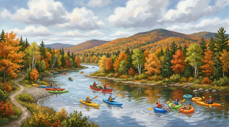
For millennia, Indigenous Wabanaki peoples traveled northern Maine's waterways in birchbark canoes connected by portages, an ancient heritage carried forward by Acadian and Quebec settlers who later built lives along the St. John and Allagash rivers. That living legacy is reflected in place names like Umsaskis Lake and Musquacook Stream. Established by the Maine Legislature in 1966 and designated as the first state-administered component of the National Wild and Scenic Rivers System in 1970, the Allagash Wilderness Waterway flows 92 miles through commercial forestland as a corridor of lakes, streams, and rivers. Paddlers running the northern Aroostook County stretch from Umsaskis Lake to the town of Allagash cover 53 miles over three to four days, passing Long Lake Dam, Round Pond, relics of nineteenth-century timber transport like historic locomotives and an old tramway, and the 40-foot drop of Allagash Falls. The northern end features landings at Michaud Farm, managed by the Maine Department of Agriculture, Conservation and Forestry, and a municipal carry-in and hard ramp in the town of Allagash, where the waterway concludes at its confluence with the St. John River.
The St. John River corridor itself winds through the North Maine Woods, where recreation downstream toward Allagash is managed through the North Maine Woods system. Its banks shelter logging remnants at Seven Islands and Nine Mile Bridge alongside more than 30 rare plant species, including the rare Furbish's lousewort. In Fort Kent, the 740-mile Northern Forest Canoe Trail reaches its official eastern terminus at Riverside Park, marking the end of a long voyage from New York that opened to paddlers in 2006. Nearby on the Fish River, paddlers can launch near the historic Fort Kent Blockhouse, completing routes through a watershed that links Portage Lake, Eagle Lake, Square Lake, Cross Lake, Mud Lake, and Long Lake. Trips run downstream through Soldier Pond, passing a 4-foot drop and the Class V Fish River Falls, with surrounding wetlands supporting deer wintering grounds, fens, waterfowl, and wading birds.
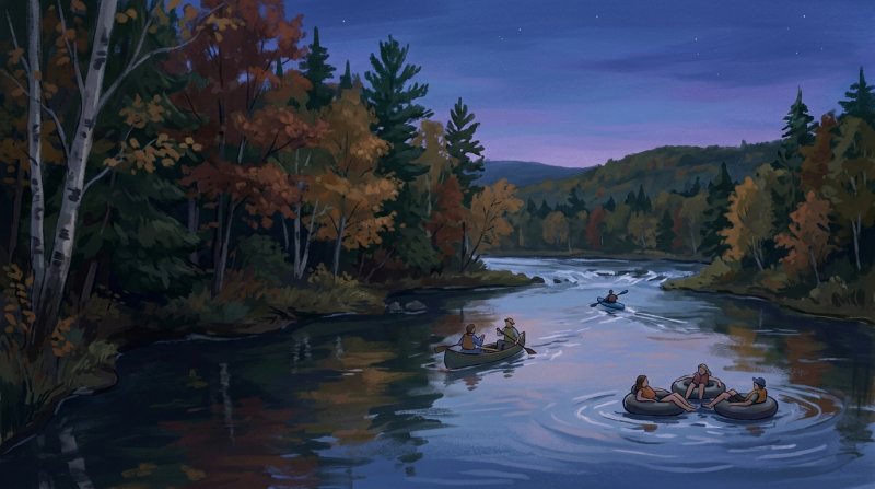
Across the county's heart, the Aroostook River flows past towns and working landscapes. Boaters can put in at facilities such as the Ashland hard-ramp launch managed by the Aroostook River Fish and Game Club or the public launch in Washburn. The river meanders ten miles between Washburn and Presque Isle, bordered by a forested riparian buffer where a bald eagle nesting site rests midway along the water, before continuing along the 13.2-mile stretch known locally as The Reach from Presque Isle down to Caribou. Further downstream toward Fort Fairfield, the river features gentle water and agricultural views, while communities celebrate their rivers with events like Caribou's annual 6.2-mile spring race and Houlton's nine-mile paddle on the Meduxnekeag River, where racers receive local potatoes. From the quiet remote ponds of the Deboullie Public Lands and the spring-fed waters of Echo Lake at Aroostook State Park to the Little Madawaska River in Connor, Aroostook's waters remain open to anyone setting out with a paddle.
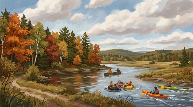
Where to go: St. John Valley · Central Aroostook · Southern Aroostook · North Woods
Rules, seasons, permits, water levels and weather change. Before you go, check current conditions and requirements with the agency that manages the place you plan to visit.
The facts behind this guide
·
Access (8)
- Allagash River Town Launch Allagash
- A municipal carry-in and hard ramp launch is situated on the Allagash River in the town of Allagash and is managed locally by the Town of Allagash.[1]
- Allagash Wilderness Waterway Michaud Farm Access Allagash River
- Michaud Farm provides a northern vehicle access point and canoe landing along the Allagash River in T15 R11 WELS within Aroostook County, with state facilities managed by the Maine Department of Agriculture, Conservation and Forestry.[1]
- Aroostook River Ashland Boat Access Ashland
- A hard-ramp boat access facility on the Aroostook River in Ashland is owned and managed by the Aroostook River Fish and Game Club.[2]
- Aroostook River Washburn Boat Launch Washburn
- The town of Washburn manages a public hard-surface boat launch on the Aroostook River.[1]
- Fish River Fort Kent Launch Fort Kent
- The Fish River features public boat access near the historic Blockhouse in the town of Fort Kent.[3]
- Hodgdon Mill Pond and South Branch Meduxnekeag River Access Hodgdon
- The Town of Hodgdon maintains a boat launching area on the western side of the dam in Hodgdon, and the Maine Department of Inland Fisheries and Wildlife maintains a boat launch off Horseback Road to access Hodgdon Mill Pond in the Lt. Gordon Manuel Wildlife Management Area.[4]
- Meduxnekeag River Watson Settlement Bridge Access Littleton
- Paddlers on the Meduxnekeag River can access the water at a launch near the Watson Settlement Covered Bridge off Framingham Road in Littleton, managed by the Maine Department of Inland Fisheries and Wildlife.[5]
- Wytopitlock Lake and Stream Boat Launch Glenwood Plantation
- The Bureau of Parks and Lands owns and maintains a boat launch in the outlet cove of Wytopitlock Lake in Glenwood Plantation, which serves as the starting point for canoe trips down Wytopitlock Stream.[6]
Culture (6)
- Allagash Waterway Logging Relics Allagash Wilderness Waterway
- Historic logging equipment remains preserved along the Allagash Wilderness Waterway corridor in Aroostook County, including abandoned timber-transport infrastructure such as an old tramway and historic locomotives.[7]
- Aroostook River Spring Runoff Race Caribou
- The Aroostook River Spring Runoff is an annual 6.2-mile flatwater canoe and kayak race held each May in Caribou celebrating seasonal spring paddling as river ice melts.[8]
- Historic St. John River Log Driving Artifacts St. John River
- The upper St. John River corridor features logging history remnants near sites like Seven Islands and Nine Mile Bridge in the Aroostook County North Maine Woods, where timber drives and supply farms operated historically.[9]
- Meduxnekeag River Canoe Race Tradition Houlton
- The annual Meduxnekeag River Canoe Race is a spring paddling tradition covering approximately 9 miles from New Limerick to downtown Houlton, where participants traditionally receive local Aroostook County potatoes as parting gifts.[10]
- Native Place Names on the Allagash Umsaskis Lake
- Native American heritage is preserved in traditional waterway names across the region, including Umsaskis Lake and Musquacook Stream in Aroostook County.[11]
- Wabanaki and Acadian Waterway Heritage Fort Kent
- Wabanaki Native Americans originally traveled the Allagash and St. John rivers in birchbark canoes for hunting and gathering, while later Acadian and Quebec settlers established communities and traditions along the same waterways in northern Aroostook County.[12]
History (7)
- Completion of the Northern Forest Canoe Trail Fort Kent
- The Northern Forest Canoe Trail was officially established in 2000 and opened for paddlers in 2006, terminating at Riverside Park in Fort Kent.[13]
- Eastern Terminus of the Northern Forest Canoe Trail Fort Kent
- Fort Kent serves as the official eastern terminus of the 740-mile Northern Forest Canoe Trail, which traces traditional Indigenous and historic canoe routes from New York to Aroostook County, Maine.[14]
- Establishment of the Allagash Wilderness Waterway Allagash Wilderness Waterway
- The Allagash Wilderness Waterway, whose northern section flows through Aroostook County to the town of Allagash, was established by the Maine Legislature in 1966 to preserve and protect its wilderness character.[15]
- Logging Impact on the Allagash Watercourse Allagash Wilderness Waterway
- In the 19th century, lumbermen altered the Allagash drainage basin by erecting dams and structures so timber could be driven toward markets, leaving historical logging artifacts that canoeists encounter along the waterway today.[16]
- National Wild and Scenic River System Designation Allagash Wilderness Waterway
- In 1970, the Allagash Wilderness Waterway became the first state-administered component included in the National Wild and Scenic Rivers System.[17]
- Traditional Wabanaki Canoe Travel Allagash River
- For millennia prior to European arrival, Indigenous Wabanaki peoples navigated the waterways of northern Maine, including the Allagash and St. John River networks, in birchbark canoes connected by portages.[18]
- Upper St. John River Canoe Corridor Management St. John River
- Public recreation and access for canoe trips running downstream along the upper St. John River corridor toward the town of Allagash are managed through the North Maine Woods recreational system.[19]
Nature (7)
- Allagash Wilderness Waterway landscape context Allagash Wilderness Waterway
- Within northern Maine, including Aroostook County, the Allagash Wilderness Waterway flows through commercial forestland as a 92-mile corridor of connected rivers, lakes, and streams designated as a National Wild and Scenic River.[20]
- Aroostook National Wildlife Refuge fall foliage timing Aroostook National Wildlife Refuge
- Due to cold northern Maine temperatures, autumn foliage at the Aroostook National Wildlife Refuge peaks early in October, coinciding with seasonal paddling and wildlife viewing.[21]
- Aroostook River riparian corridor and scenery Aroostook River
- The Aroostook River corridor between Washburn and Presque Isle is lined with forested riparian buffers that provide a scenic viewshed and connectivity habitat for area-sensitive wildlife species.[22]
- Deboullie ponds landscape and native fish species Deboullie Public Lands
- The Deboullie Public Lands in north-central Aroostook County feature 17 remote ponds set among low rugged mountains, supporting native brook trout, landlocked salmon, and rare blueback trout (landlocked Arctic charr).[23]
- Little Madawaska River paddling and wildlife corridor Connor Township
- The Little Madawaska River runs for 3.5 miles through the Aroostook National Wildlife Refuge in Connor, offering an undisturbed waterway for canoeing, kayaking, and wildlife observation.[24]
- Portage Lake wetland mosaic and deer wintering area Fish River
- The wetland complex surrounding Portage Lake and the Fish River includes two large unpatterned fen ecosystems that serve as significant habitat for inland waterfowl, wading birds, and wintering deer.[25]
- St. John River plant diversity St. John River
- The banks of the St. John River support more than 30 rare plant species, which is more than any other area in Maine outside Mount Katahdin, including the rare Furbish's lousewort in Aroostook County.[26]
Routes (8)
- Allagash Falls Portage and Twin Brook Run T15 R10 WELS
- Paddlers on the northern Aroostook County segment of the Allagash Wilderness Waterway portage one-third of a mile around Allagash Falls before running 8 miles to Twin Brook Rapids, which marks the official waterway boundary.[27]
- Allagash Wilderness Waterway Umsaskis Lake to Allagash Route Allagash Wilderness Waterway
- Within Aroostook County, the paddling route from Umsaskis Lake to the Town of Allagash covers 53 miles, typically takes 3 to 4 days of mostly river paddling, and takes paddlers past Long Lake Dam, Round Pond, and the 40-foot drop of Allagash Falls.[27]
- Aroostook River Caribou to Fort Fairfield Section Aroostook River
- The 14-mile river trip from the Lower Lyndon Street launch in Caribou to Fort Fairfield passes forested riverbanks and farmland, with an intermediate hand-carry access point located at Forbes Pit near the town line.[28]
- Aroostook River Presque Isle to Caribou Section Aroostook River
- Known locally as 'The Reach', this 13.2-mile paddling trip on the Aroostook River flows north from the US-1 launch in Presque Isle to Caribou, featuring mostly flat water, low islands near Merritt Brook, and an impoundment above the Caribou dam.[29]
- Aroostook River Washburn to Presque Isle Route Aroostook River
- The Aroostook River section from Washburn to Presque Isle is an approximately 10-mile paddling route with mostly flatwater, minor rips, views of farms and woodlands, and a bald eagle nesting site midway along the route.[30]
- Echo Lake Paddling at Aroostook State Park Presque Isle
- Aroostook State Park provides trailerable and hand-carry boat launch access directly to Echo Lake, where visitors can paddle beneath Quaggy Jo Mountain.[31]
- Fish River Eagle Lake to Soldier Pond Route Fish River
- The paddle from the town of Eagle Lake to the village of Soldier Pond covers 3.8 miles on the Fish River after crossing through the northern end of Eagle Lake to a take-out located immediately past the bridge in Soldier Pond.[32]
- Fish River Soldier Pond to Fort Kent Section Fish River
- The Fish River paddling trip from the boat landing in Soldier Pond to the public landing in Fort Kent passes a 4-foot drop at mile 1, the Class V Fish River Falls at mile 5 requiring a portage, and finishes opposite the historic Fort Kent Blockhouse.[33]
Waterways (8)
- Allagash Wilderness Waterway Northern Terminus Route Allagash
- The Northern Forest Canoe Trail follows the northern stretch of the Allagash Wilderness Waterway through Aroostook County to the town of Allagash, where the waterway concludes at the confluence with the Saint John River.[34]
- Aroostook River Caribou to Fort Fairfield Paddle Aroostook River
- The Aroostook River route from Caribou to Fort Fairfield spans 12.20 miles one way, offering gentle flatwater and minor rips suitable for novice paddlers.[35]
- Aroostook River Presque Isle to Caribou Paddle Aroostook River
- The paddling segment of the Aroostook River between Presque Isle and Caribou extends 13.20 miles one way, passing forested banks and agricultural lands.[29]
- Echo Lake Paddling at Aroostook State Park Presque Isle
- Aroostook State Park encompasses spring-fed Echo Lake at the base of Quaggy Jo Mountain, serving as a designated destination for flatwater paddling, trout fishing, and boating access.[36]
- Fish River Chain of Lakes Waterway Fish River Chain of Lakes
- The Fish River Chain of Lakes connects a series of waterways, including Portage Lake, Eagle Lake, Square Lake, Cross Lake, Mud Lake, and Long Lake, allowing continuous lake-to-lake paddling routes in Aroostook County.[37]
- Fish River ME-11 to Eagle Lake Paddle Fish River
- The Fish River paddling route from the Route 11 bridge downriver to the public boat launch on Eagle Lake measures 4.0 miles one way, providing a gentle flatwater trip with no rapids.[38]
- Little Madawaska River Paddling Reach Connor
- The Little Madawaska River flows through Aroostook National Wildlife Refuge, providing 3.5 miles of calm-water paddling and wildlife viewing opportunities in Connor.[24]
- Northern Forest Canoe Trail Fort Kent Terminus Fort Kent
- The international eastern terminus of the 740-mile Northern Forest Canoe Trail ends on the Saint John River at Riverside Park in Fort Kent.[37]
Sources (38)
- Boat Sites: Public Boat Launches: Boating Opportunities: Water Activities: State Parks and Public Lands: Maine DACF — maine.gov , viewed Oct 9, 2026
- Site List - Maine.gov — maine.gov , viewed Oct 10, 2026
- FISHING - Maine.gov — maine.gov , viewed Oct 10, 2026
- Gordon Manuel WMA Offers Fishing, Hunting, Canoeing and Much More - Maine.gov — meifw.wordpress.com , viewed Oct 10, 2026
- Maine River Trips | IFW Blogs — meifw.wordpress.com , viewed Oct 10, 2026
- WYTOPITLOCK LAKE - Maine.gov — maine.gov , viewed Oct 10, 2026
- Allagash Wilderness Waterway | Visit Aroostook — visitaroostook.com , viewed Oct 10, 2026
- Aroostook River Spring Run Off — visitaroostook.com , viewed Oct 10, 2026
- Saint John River Canoe Trip, Maine, 6-7 Days — canoethewild.com , viewed Oct 10, 2026
- Meduxnekeag River Canoe Race | Visit Aroostook — visitaroostook.com , viewed Oct 10, 2026
- Paddling in Aroostook — visitaroostook.com , viewed Oct 10, 2026
- Allagash and St. John Rivers - The Historical Marker Database — hmdb.org , viewed Oct 10, 2026
- Northern Forest Canoe Trail Celebrates 25 Years — northernforestcanoetrail.org , viewed Oct 10, 2026
- Northern Forest Canoe Trail - Wikipedia — en.wikipedia.org , viewed Oct 10, 2026
- Allagash Wilderness Waterway - Maine.gov — maine.gov , viewed Oct 10, 2026
- Allagash History: Parks and Public Lands: Maine DACF — maine.gov , viewed Oct 10, 2026
- Allagash River | Rivers.gov - U.S. Fish and Wildlife Service — rivers.gov , viewed Oct 10, 2026
- Allagash Explorer - Allagash Wilderness Waterway Foundation — awwf.org , viewed Oct 10, 2026
- St. John River Canoe Guide - North Maine Woods — northmainewoods.org , viewed Oct 10, 2026
- Allagash Wilderness Waterway - Maine.gov — maine.gov , viewed Oct 10, 2026
- A fall foliage tour of the Northeast | U.S. Fish & Wildlife Service — fws.gov , viewed Oct 10, 2026
- Aroostook River- Washburn to Presque Isle - Maine.gov — maine.gov , viewed Oct 10, 2026
- Deboullie Public Land Guide & Map - Maine.gov — maine.gov , viewed Oct 10, 2026
- Boating - non-motorized at Aroostook National Wildlife Refuge | FWS.gov — fws.gov , viewed Oct 10, 2026
- Focus Areas of Statewide Ecological Significance: Portage Lake Wetland Mosaic - Maine.gov — maine.gov , viewed Oct 10, 2026
- A Landowner's Guide to Conservation of Furbish's Lousewort and the St. John River - Maine.gov — maine.gov , viewed Oct 10, 2026
- Allagash Wilderness Waterway - Maine.gov — maine.gov , viewed Oct 10, 2026
- Yeti river trail - Undiscovered Maine — umaine.edu , viewed Oct 10, 2026
- Aroostook River Paddling Route (Presque Isle to Caribou) - Maine Trail Finder — mainetrailfinder.com , viewed Oct 10, 2026
- Aroostook River Paddling Route & Race Course (Washburn to Presque Isle) - Maine Trail Finder — mainetrailfinder.com , viewed Oct 10, 2026
- Aroostook State Park - Maine.gov — maine.gov , viewed Oct 10, 2026
- Eagle Lake to Soldier Pond Paddle Route - Maine Trail Finder — mainetrailfinder.com , viewed Oct 10, 2026
- Fish River (Soldier Pond to Fort Kent) - Maine Trail Finder — mainetrailfinder.com , viewed Oct 10, 2026
- Allagash Wilderness Waterway - Maine Trail Finder — mainetrailfinder.com , viewed Oct 9, 2026
- Aroostook River Paddling Route (Caribou to Fort Fairfield) - Maine Trail Finder — mainetrailfinder.com , viewed Oct 10, 2026
- Aroostook State Park - Maine.gov — maine.gov , viewed Oct 10, 2026
- Paddling in Aroostook — visitaroostook.com , viewed Oct 10, 2026
- Fish River (ME-11 to Eagle Lake) - Maine Trail Finder — mainetrailfinder.com , viewed Oct 10, 2026
Last updated October 10, 2026.