Hunting
The Last True Frontier of Maine Hunting.
Hunting in Aroostook County is rooted in expansive waterways and vast woodlands, from the protected corridor of the Allagash Wilderness Waterway to the connected waters of the Fish River Chain of Lakes. Sporting traditions run deep here, shaped by indigenous heritage, historic camps, and forest checkpoints that welcome sportsmen into the North Maine Woods.
 Your logo here
This page could be sponsored
Your business name here
Sponsor This Page
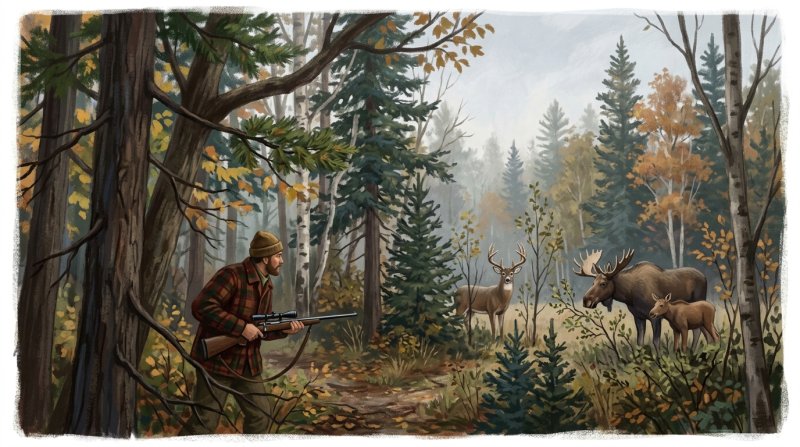
Across northern Aroostook County, flowing waters define the hunting terrain. The 92-mile Allagash Wilderness Waterway permits hunting amid its primitive corridor before meeting the St. John River near Allagash Village, and its wide section at Round Pond is buffered by a 20,000-acre public reserved land unit that draws hunters each fall. Further east, the Fish River Chain of Lakes connects waters like Eagle Lake, Fish River Lake, Portage Lake, and St. Froid Lake for outdoor sporting, complemented by the Fish River Conservation Easement protecting pedestrian hunting access across roughly 16,000 to 17,000 acres near Mud Lake, Cross Lake, Square Lake, and Carry Pond. Hunters also look to the Aroostook River, which edges the 223-acre Pollard Flat Wildlife Management Area in Masardis, and the remote forests along the Saint John River border.
Reaching these game lands follows storied routes through woods and waters. Sportsmen enter the North Maine Woods network through checkpoints maintained by North Maine Woods, Inc., such as the Fish River Checkpoint in township T13 R7 WELS and the Little Black Checkpoint near Dickey. The Allagash River offers public carry-in launches, including state-managed gravel sites in townships T10 R12 WELS, T13 R12 WELS, and T15 R11 WELS, alongside the municipal launch in Allagash. For those traversing the Fish River waterways, public access extends from Old Main Street in Eagle Lake down through the 17-mile run to the historic Fort Kent Blockhouse landing.
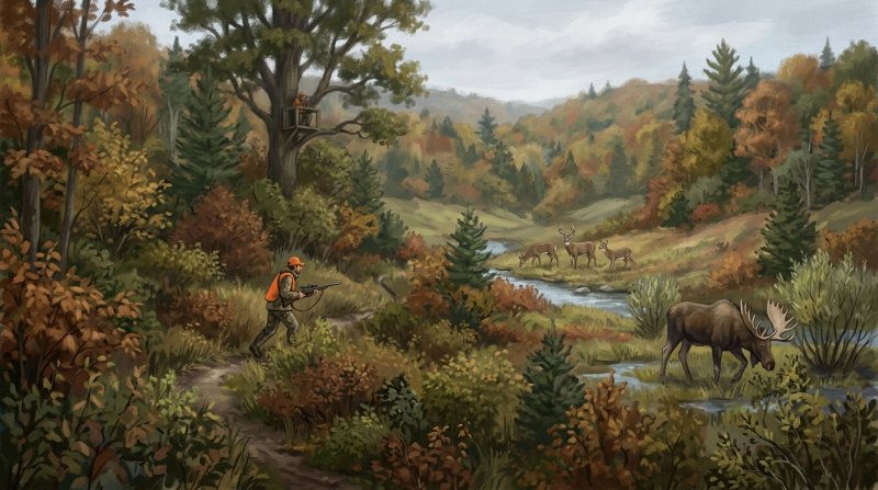
The country itself ranges from the 1,470-foot ridgeline of Scopan Mountain to the rugged expanse of Deboullie Public Reserved Land, where 21,871 acres encompass 17 ponds and a 7,253-acre Ecological Reserve of old-growth spruce and mature hardwoods. In Limestone, Aroostook National Wildlife Refuge hosts game species like white-tailed deer, moose, snowshoe hare, spruce grouse, ruffed grouse, and American woodcock across its wetlands and woods.
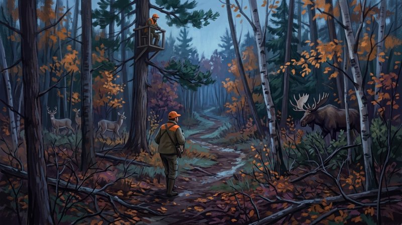
These grounds carry generations of hunting tradition. In Township 9, Range 8 WELS, Almond Currier and Roach Adams founded Chandler Lake Camps in 1902 centered on caribou, moose, and whitetail deer hunting, where guides still preserve traditional preseason scouting and moose calling with handmade birch bark horns. Along the river in Allagash, Tylor Kellys Camps provides access to surrounding commercial timberlands, carrying forward a legacy shared with early camps that grew out of timber sites like Churchill Depot. This sporting way of life echoes an older lineage, seen in the Mi'kmaq tradition where hunters gathered to share harvests and celebrate with dances that evolved into modern pow-wows.
Where to go: St. John Valley · Central Aroostook · Southern Aroostook · North Woods
Rules, seasons, permits, water levels and weather change. Before you go, check current conditions and requirements with the agency that manages the place you plan to visit.
The facts behind this guide
·
Access (8)
- Allagash Municipal Launch Allagash
- A public carry-in and hard ramp facility provides water access on the Allagash River in the town of Allagash. The facility is under local municipal ownership.[1]
- Eagle Lake Public Boat Landing Eagle Lake
- A public boat landing providing water access to Eagle Lake and the connecting Fish River waterway is situated on Old Main Street in the town of Eagle Lake.[2]
- Fish River Checkpoint Access T13 R7 WELS
- The Fish River Checkpoint serves as a major land and water recreation entry point into the North Maine Woods network in township T13 R7 WELS. It is operated and maintained by North Maine Woods, Inc.[3]
- Little Black Checkpoint Access Dickey
- The Little Black Checkpoint operates as an entry checkpoint for outdoor recreation access into the North Maine Woods near the community of Dickey in western Aroostook County. The checkpoint is managed by North Maine Woods, Inc.[4]
- Long Lake Van Buren Cove Access Long Lake
- The beach and shorefront at Van Buren Cove on Long Lake functions as an established public water access point in the Fish River Chain of Lakes region.[5]
- T10 R12 WELS Allagash River Access T10 R12 WELS
- A gravel carry-in boat launch provides water access to the Allagash River in township T10 R12 WELS. It is managed as a state public facility by the Maine Department of Agriculture, Conservation and Forestry.[1]
- T13 R12 WELS Allagash River Launch T13 R12 WELS
- A state-owned gravel carry-in launch site provides access to the Allagash River in township T13 R12 WELS. The facility is managed by the Maine Department of Agriculture, Conservation and Forestry.[1]
- T15 R11 WELS Allagash River Access T15 R11 WELS
- Two gravel carry-in access sites are located on the Allagash River in township T15 R11 WELS. Both sites are state-owned and managed by the Maine Department of Agriculture, Conservation and Forestry.[1]
Conservation (5)
- Controlled Moose Hunt in Eastern Aroostook County Caribou
- MDIFW established a specialized controlled moose hunt across agricultural zones in eastern Aroostook County to reduce commercial crop damage and moose-vehicle collisions outside standard recreational season allocations.[6]
- GPS Moose Survival and Winter Tick Research Wildlife Management District 2
- MDIFW biologists expanded their multi-year GPS-collar research study to Aroostook County's Wildlife Management District 2 to monitor adult and calf survival rates, habitat use, and parasite impacts to guide sustainable hunting permit quotas.[7]
- MDIFW Caribou Stream Deer Wintering Habitat Acquisition Washburn
- The Maine Department of Inland Fisheries and Wildlife acquired 930 acres across Washburn and Woodland to restore and protect critical conifer deer wintering habitat while keeping the land open to public hunting.[8]
- MDIFW Macwahoc Stream WMA Acquisition Upper Molunkus Township
- The Maine Department of Inland Fisheries and Wildlife partnered with The Conservation Fund to acquire 6,411 acres of deer wintering and wetland habitat along Macwahoc Stream and Juniper Brook, keeping the property open for general hunting.[9]
- Waterfowl Box Management at Sawtelle Deadwater WMA T6 R7 WELS
- MDIFW maintains approximately 15 artificial nesting boxes for cavity-nesting waterfowl such as wood ducks and common goldeneyes on Sawtelle Deadwater WMA, where waterfowl hunting is a primary recreational activity.[9]
Culture (8)
- Foundation of Chandler Lake Camps Township 9, Range 8 WELS
- Chandler Lake Camps was established in 1902 by hunter and trapper Almond Currier and Roach Adams as a sporting camp centered on caribou, moose, and whitetail deer hunting.[10]
- Historic Wilderness Sporting Camp at Allagash Allagash
- Tylor Kellys Camps operates along the river in Allagash, providing guided sporting and hunting access to millions of acres of surrounding commercial timberland.[11]
- Houlton Band of Maliseet Indian Recognition Day Littleton
- The Houlton Band of Maliseet Indians commemorates their federal recognition and ancestral heritage each September with public cultural displays, dancing, and drumming.[12]
- Logging Heritage of Molunkus Lake Sporting Camps Macwahoc Plantation
- The main lodge at Molunkus Lake Sporting Camps was constructed by lumbermen in the late 1800s before opening for sporting guests in 1904.[13]
- Mi'kmaq Hunter Pow-wow Tradition Presque Isle
- Historically among the Mi'kmaq, hunters held gatherings where they invited friends and family to share their harvest, accompanied by celebratory dancing that evolved into modern pow-wows.[14]
- Mi'kmaq Nation Mawiomi of Tribes Caribou
- The Mi'kmaq Nation hosts the annual Mawiomi of Tribes gathering each August at Spruce Haven to celebrate indigenous cultural traditions and heritage.[12]
- Swedish Settlement of New Sweden New Sweden
- The state of Maine established the Swedish Colony on July 23, 1870, when William Widgery Thomas Jr. brought the first 51 Swedish immigrants to settle the forested wilderness of northern Aroostook County.[15]
- Traditional Birch Bark Horn Moose Calling Township 9, Range 8 WELS
- Sporting guides in northern Aroostook County preserve the traditional moose-hunting technique of preseason scouting paired with calling using handmade birch bark horns.[16]
Game and wildlife (6)
- Aroostook black bear harvest share Aroostook County
- Aroostook County accounts for the largest share of Maine's total black bear harvest, registering 1,103 bears or 29 percent of the statewide harvest in 2021.[17]
- Aroostook game species Aroostook County
- Aroostook County supports hunting for major game species including black bear, moose, white-tailed deer, ruffed grouse, wild turkey, and migratory waterfowl.[18]
- Disabled veterans controlled moose hunt Aroostook County
- The Maine Department of Inland Fisheries and Wildlife allocates 25 moose hunting permits annually for a controlled moose hunt in eastern Aroostook County designated for disabled veterans.[19]
- North Maine Woods hunted game North Maine Woods
- The vast commercial forestlands of the North Maine Woods in western and northern Aroostook County provide established hunting grounds for moose, whitetail deer, black bear, ruffed grouse, and woodcock.[20]
- Pollard Flat WMA hunting game Masardis
- Pollard Flat Wildlife Management Area along the Aroostook River drainage is utilized during fall hunting seasons for bear, moose, deer, ruffed grouse, woodcock, and waterfowl.[21]
- Wild turkey range expansion Aroostook County
- Wild turkeys have expanded into northern Maine, providing spring hunting opportunities in northeast Aroostook County's Wildlife Management Districts 3 and 6.[22]
Guides and camps (8)
- Aroostook sporting camp hunting tradition T9 R8 WELS
- Historic sporting camps in remote Aroostook townships such as T9 R8 have operated traditional hunting lodges since the early 1900s, guiding hunters for moose, whitetail deer, and ruffed grouse in the North Maine Woods.[16]
- Bangor and Aroostook Railroad expansion to hunting lodges Masardis
- When the Bangor and Aroostook Railroad extended lines to Aroostook County towns such as Masardis and Ashland in 1896, local operators converted remote former lumber camps along waterways into sporting camps to host traveling hunters.[23]
- Munsungan hunting camp tradition Munsungan Lake
- Backcountry camps around Munsungan Lake have hosted hunters pursuing big game with local Maine Master Guides for generations, relying on waterway navigation and remote logging routes.[24]
- North Maine Woods hunting camp heritage Allagash
- The Allagash region serves as an enduring base for multi-generational sporting camps where Registered Maine Guides lead hunters into millions of acres of working forest for deer, moose, and bear.[25]
- Rail transit expansion into northern hunting grounds Ashland
- The arrival of rail transportation to Ashland in 1896 enabled sportsmen to reach remote wilderness areas for big game hunting, prompting the growth of sporting lodges across the Fish River and Aroostook River drainages.[23]
- Specialized Hunting Registered Maine Guide licensing Ashland
- Since the inception of guide licensing in 1897 and standardized testing established in 1975, guides working the forests of Aroostook County must earn a Specialized Hunting classification to legally guide hunting and trapping parties.[26]
- Traditional birch bark horn moose calling Chandler Lake
- Guides in the Chandler Lake area continue the traditional method of hunting moose by preseason scouting combined with calling using a handmade birch bark horn.[16]
- Traditional deer camps of the North Maine Woods Northwest Aroostook
- Generations of hunters have maintained a tradition of using remote woodland camps and logging road networks across Aroostook County as seasonal base stations for tracking mature whitetail deer, moose, and bear.[27]
History (6)
- Allagash Waterway State Designation Allagash
- The Maine Legislature established the Allagash Wilderness Waterway in 1966 to preserve the natural character and habitat along its lakes, rivers, and streams, which end in northern Aroostook County.[28]
- Allagash Wild and Scenic River Protection Allagash
- On July 19, 1970, the Allagash Wilderness Waterway became the first state-administered river corridor added to the federal National Wild and Scenic Rivers System.[29]
- Bangor and Aroostook Railroad Sporting Access to Fort Kent Fort Kent
- The Bangor and Aroostook Railroad completed an extension of its Ashland branch to Fort Kent in 1902, opening rail passenger access to the interior waterways of northern Aroostook County for sportsmen and game hunters.[30]
- Fish River Chain Waterway Expedition Route Fish River
- The Fish River waterway route connects Eagle Lake to the historic Fort Kent Blockhouse landing over a 17-mile run historically navigated by canoeists and sporting parties in northern Aroostook County.[31]
- Historic Sporting Camps on the Allagash Churchill Depot
- Early sporting visitors traveling waterways in northern Maine relied on timber facilities like Churchill Depot for supply points before dedicated sporting camps were established along the corridor for hunters and fishermen.[29]
- Saint Francis Rail Terminal and Waterway Access St. Francis
- In 1910, the Bangor and Aroostook Railroad extended rails up the Saint John River to Saint Francis, establishing the end of the line and facilitating guided expeditions to the far northern border waterways.[30]
Where people hunt (7)
- Aroostook Wildlife Management Districts Hunting Allocation Aroostook County
- The Maine Department of Inland Fisheries and Wildlife delineates Aroostook County across Wildlife Management Districts 1, 2, 3, 4, 5, 6, and 11 to regulate and manage wildlife harvest and hunting opportunities.[18]
- Ashland Gateway to North Maine Woods Hunting Ashland
- Ashland serves as a major gateway and base town for hunters travelling into the commercial forestlands and remote tracts managed under the North Maine Woods recreational system.[18]
- Deboullie Public Reserved Land Hunting Opportunities T15 R9 WELS
- Encompassing 21,871 acres in T15 R9 WELS within the North Maine Woods, the Deboullie Public Reserved Land is open to hunting for species such as ruffed grouse and moose.[32]
- Dickwood Lake Wildlife Management Area Hunting Habitat Eagle Lake
- Dickwood Lake Wildlife Management Area covers 3,860 acres in northern Aroostook County, where regenerating spruce-fir forest provides hunting opportunities for ruffed grouse, woodcock, moose, and black bear.[33]
- Eagle Lake Public Reserved Land Hunting Eagle Lake
- The 24,083-acre Eagle Lake Public Reserved Land unit on the eastern half of Eagle Lake offers public forest hunting access along with fishing, camping, and wildlife watching.[34]
- Scopan Public Reserved Land Hunting Access Ashland
- Located south of Ashland and bordering Scopan Lake, the roughly 16,700-acre Scopan Public Reserved Land unit provides semi-remote public forest terrain open to hunting.[35]
- Squapan Unit Multi-Use Hunting Grounds Presque Isle
- The Squapan Public Reserved Land unit covers nearly 20,000 acres near Presque Isle, providing public opportunities for hunting in a managed working forest landscape.[36]
Nature (7)
- Aroostook National Wildlife Refuge Bird Habitats Limestone
- The refuge's forests and wetlands host upland game and migratory birds including spruce grouse, ruffed grouse, American woodcock, waterfowl, and northern goshawk.[37]
- Aroostook National Wildlife Refuge Mammal Species Limestone
- Mammals inhabiting the refuge include moose, white-tailed deer, snowshoe hare, beaver, Canada lynx, river otter, mink, ermine, and coyote.[37]
- Deboullie Ecological Reserve Forest Wildlife Habitat T15 R9 WELS
- Deboullie contains a 7,253-acre Ecological Reserve featuring mature hardwood and old-growth spruce stands that host species such as Canada lynx and northern bog lemming.[38]
- Deboullie Landscape Complexity T15 R9 WELS
- An analysis by The Nature Conservancy determined that Deboullie Public Reserved Land exhibits some of the greatest landscape complexity in Aroostook County due to its rolling terrain, wetlands, and aquatic habitats.[39]
- Deboullie Public Reserved Land Size and Water Bodies T15 R9 WELS
- Deboullie Public Reserved Land covers 21,871 acres in northwestern Aroostook County and encompasses 17 ponds set among low, rugged mountains.[40]
- Scopan Mountain Elevation and Terrain Scopan Township
- The Scopan unit features rugged topography including Scopan Mountain, a north-south ridgeline that reaches an elevation of 1,470 feet at its peaks.[41]
- Scopan Unit Waterfowl and Wading Bird Habitat Scopan Township
- The Scopan Mountain area contains roughly 500 acres of Significant Wildlife Habitat designated for inland waterfowl and wading birds.[42]
Routes (8)
- Allagash Wilderness Waterway Course and Terminus Allagash
- The Allagash Wilderness Waterway flows northward through northern Maine to its northern terminus at the confluence with the St. John River near Allagash Village in Aroostook County, with the full waterway spanning 92 miles.[43]
- Aroostook River Confluence and Course Aroostook River
- The Aroostook River forms at the confluence of Munsungun Stream and Millinocket Stream in western Aroostook County and flows northeast through Ashland, Presque Isle, Caribou, and Fort Fairfield before crossing into New Brunswick.[44]
- Aroostook River Masardis to Ashland Segment Ashland
- The section of the Aroostook River between the boat launch in Masardis and Ashland flows north through flat water with gentle rips, joining the Big Machias River about one mile above the Ashland bridge.[45]
- Aroostook River Route from Washburn to Presque Isle Presque Isle
- The paddling segment of the Aroostook River from Washburn to Presque Isle spans approximately 10 miles of mostly flatwater and gentle riffles, passing farmland, woodlands, and a bald eagle nesting site.[46]
- Fish River Chain of Lakes Route Fish River
- The Fish River Chain of Lakes connects multiple water bodies including Eagle Lake, Portage Lake, Square Lake, Long Lake, and Mud Lake, allowing paddlers to transition between connected lakes across northern Aroostook County.[47]
- Fish River Route to Eagle Lake Eagle Lake
- The flatwater section of the Fish River from Route 11 to the public boat landing on Eagle Lake spans 4.0 miles one way, passing cedar-lined shorelines and a large hardwood island at the river's mouth.[2]
- Fish River Run from Soldier Pond to Fort Kent Fish River
- The Fish River paddle from the boat landing in Soldier Pond to the public landing in Fort Kent spans 10 miles and passes Fish River Falls, ending across from the historic Fort Kent Blockhouse.[48]
- Northern Forest Canoe Trail Terminus Fort Kent
- The 740-mile Northern Forest Canoe Trail follows 80 miles of the Allagash Wilderness Waterway route before reaching its eastern terminus on the St. John River in Fort Kent.[49]
Waterways (6)
- Allagash Wilderness Waterway corridor Allagash Wilderness Waterway
- The Allagash Wilderness Waterway is a 92-mile protected ribbon of lakes, ponds, rivers, and streams extending through northern Maine into northern Aroostook County, where it permits hunting alongside primitive wilderness recreation.[50]
- Aroostook River floodplain habitat Aroostook River
- The Aroostook River forms the eastern border of the 223-acre Pollard Flat Wildlife Management Area in Masardis, offering river floodplain habitat open to hunting.[51]
- Fish River Chain of Lakes recreation area Fish River
- The Fish River Chain of Lakes encompasses a connected system including Eagle Lake, Fish River Lake, Portage Lake, and St. Froid Lake in northern Aroostook County, which are widely utilized for hunting, fishing, and outdoor sports.[52]
- Fish River Conservation Easement Square Lake
- The Fish River Conservation Easement covers roughly 16,000 to 17,000 acres adjacent to Mud Lake, Cross Lake, Square Lake, and Carry Pond in Aroostook County, securing permanent pedestrian access for hunting and recreation.[53]
- Round Pond hunting area Round Pond
- Round Pond is a wide section of the Allagash River surrounded by a 20,000-acre public reserved land unit in western Aroostook County that serves as a popular hunting destination during the fall.[54]
- Upper Saint John River watershed Saint John River
- The Saint John River borders northern and western Aroostook County through remote woodlands where surrounding forest lands provide access to fall game hunting.[55]
Sources (55)
- Boat Sites: Public Boat Launches: Boating Opportunities: Water Activities: State Parks and Public Lands: Maine DACF — maine.gov , viewed Oct 9, 2026
- Fish River (ME-11 to Eagle Lake) - Maine Trail Finder — mainetrailfinder.com , viewed Oct 10, 2026
- Fish River – North Maine Woods - Checkpoints — northmainewoods.org , viewed Oct 10, 2026
- Little Black - Checkpoints - North Maine Woods — northmainewoods.org , viewed Oct 10, 2026
- 5. Location of Property: List all towns, townships, and plantations that include land proposed for rezoning to the P-RP subdist - Maine.gov — maine.gov , viewed Oct 10, 2026
- State of Big Game Species | State of Maine's Environment 2014 - Colby College — web.colby.edu , viewed Oct 14, 2026
- Report from the Department of Inland Fisheries & Wildlife - Maine State Legislature — legislature.maine.gov , viewed Oct 14, 2026
- Deer in Aroostook County are getting help to survive the winter - Bangor Daily News — bangordailynews.com , viewed Oct 14, 2026
- Maine's Wildlife Management Areas - ArcGIS StoryMaps — storymaps.arcgis.com , viewed Oct 14, 2026
- About Chandler - Chandler Lake Camps and Lodge — chandlerlakecamps.com , viewed Oct 10, 2026
- Sporting Camps in Aroostook County; Where Adventure Awaits! — visitaroostook.com , viewed Oct 10, 2026
- Native American Heritage of Aroostook County — visitaroostook.com , viewed Oct 10, 2026
- Molunkus Lake Sporting Camps — Historic Maine Wilderness Cabins Since 1904 — molunkuslake.com , viewed Oct 10, 2026
- Aroostook Band of Micmacs - Destination Native America — aianta.org , viewed Oct 10, 2026
- New Sweden - Undiscovered Maine — umaine.edu , viewed Oct 10, 2026
- Maine Hunting - Chandler Lake Camps and Lodge — chandlerlakecamps.com , viewed Oct 10, 2026
- RESEARCH + MANAGEMENT REPORT - Maine.gov — maine.gov , viewed Oct 14, 2026
- Hunting in Aroostook — visitaroostook.com , viewed Oct 14, 2026
- Moose Permit: Moose: Game Species: Hunting: Hunting & Trapping: Maine Dept of Inland Fisheries and Wildlife - Maine.gov — maine.gov , viewed Oct 14, 2026
- Hunting in North Maine Woods — Moose, Deer, Bear & Bird Seasons | NMWMap — nmwmap.com , viewed Oct 14, 2026
- Pollard Flat Wildlife Management Area | IFW Blogs - Maine.gov — maine.gov , viewed Oct 14, 2026
- GAME SPECIES CONSERVATION & MANAGEMENT - Maine.gov — maine.gov , viewed Oct 14, 2026
- Abiding Sportsmanship | The Maine Mag — themainemag.com , viewed Oct 14, 2026
- Our History of Outdoor Maine Guides | Libby's Lodge & Canty's | Mt. Chase — libbyslodge.com , viewed Oct 14, 2026
- Sporting Camps in Aroostook County; Where Adventure Awaits! — visitaroostook.com , viewed Oct 14, 2026
- Registered Maine Guides: Programs & Resources: Maine Dept of Inland Fisheries and Wildlife - Maine.gov — maine.gov , viewed Oct 14, 2026
- Hunting in North Maine Woods — Moose, Deer, Bear & Bird Seasons | NMWMap — nmwmap.com , viewed Oct 14, 2026
- AWW / PRC – North Maine Woods — northmainewoods.org , viewed Oct 10, 2026
- Allagash River | Rivers.gov - U.S. Fish and Wildlife Service — rivers.gov , viewed Oct 10, 2026
- Right of Way and Track Maps of the Bangor & Aroostook Railroad Co. MCC-00453 Finding Aid Prepared by Anne Chamberland, Febru — digitalcommons.library.umaine.edu , viewed Oct 10, 2026
- The Fish River - Northern Door Inn — northerndoorinn.com , viewed Oct 10, 2026
- Deboullie Public Reserved Land | NRCM - Natural Resources Council of Maine — nrcm.org , viewed Oct 14, 2026
- A Look at Dickwood Wildlife Management Area | IFW Blogs - Maine.gov — maine.gov , viewed Oct 9, 2026
- Eagle Lake Public Reserved Land | NRCM - Natural Resources Council of Maine — nrcm.org , viewed Oct 14, 2026
- Scopan Public Reserved Land - Visit Aroostook — visitaroostook.com , viewed Oct 14, 2026
- V. Resources, Issues and Management Recommendations for Public Reserved Lands within the Plan Area - Squapan Unit - Maine.gov — maine.gov , viewed Oct 14, 2026
- Wildlife watching at Aroostook National Wildlife Refuge | FWS.gov — fws.gov , viewed Oct 10, 2026
- Deboullie Public Reserved Land | NRCM - Natural Resources Council of Maine — nrcm.org , viewed Oct 10, 2026
- Deboullie Public Reserve Lands - Maine.gov — maine.gov , viewed Oct 10, 2026
- Deboullie Public Land Guide & Map - Maine.gov — maine.gov , viewed Oct 10, 2026
- V. Resources, Issues and Management Recommendations for Public Reserved Lands within the Plan Area - Squapan Unit - Maine.gov — maine.gov , viewed Oct 10, 2026
- Focus Areas of Statewide Ecological Significance: Scopan Mountain - Maine.gov — maine.gov , viewed Oct 10, 2026
- Allagash Wilderness Waterway Conditions and Alerts: Water Activities: Bureau of Parks and Lands - Maine.gov — maine.gov , viewed Oct 10, 2026
- Aroostook River Canoe Trip — trips.jackmtn.com , viewed Oct 10, 2026
- Aroostook River Paddling Route (Masardis to Ashland) - Maine Trail Finder — mainetrailfinder.com , viewed Oct 10, 2026
- Aroostook River Paddling Route & Race Course (Washburn to Presque Isle) - Maine Trail Finder — mainetrailfinder.com , viewed Oct 10, 2026
- Paddling in Aroostook — visitaroostook.com , viewed Oct 10, 2026
- Fish River (Soldier Pond to Fort Kent) - Maine Trail Finder — mainetrailfinder.com , viewed Oct 10, 2026
- Allagash Wilderness Waterway - Maine Trail Finder — mainetrailfinder.com , viewed Oct 9, 2026
- Allagash Wilderness Waterway - Maine.gov — maine.gov , viewed Oct 10, 2026
- Pollard Flat Wildlife Management Area | IFW Blogs - Maine.gov — mefishwildlife.com , viewed Oct 10, 2026
- Trout Fishing Adventures in Maine's Aroostook County — visitaroostook.com , viewed Oct 10, 2026
- Fish River Chain of Lakes - Forest Society of Maine — fsmaine.org , viewed Oct 10, 2026
- Round Pond Public Reserved Land | NRCM - Natural Resources Council of Maine — nrcm.org , viewed Oct 10, 2026
- FAA ANNOUNCES IDENTIFIER FOR REOPENED MAINE AIRPORTS — theraf.org , viewed Oct 10, 2026
Last updated October 10, 2026.