Hiking and Walking
Trails From Quaggy Jo to the International Appalachian Trail
Hiking and walking in Aroostook County leads along mountain ridges, across ecological reserves, and down historic converted railbeds. The region offers everything from quiet woodland boardwalks and family-friendly river paths to rugged backcountry climbs past boulder fields and ice caves.
 Your logo here
This page could be sponsored
Your business name here
Sponsor This Page
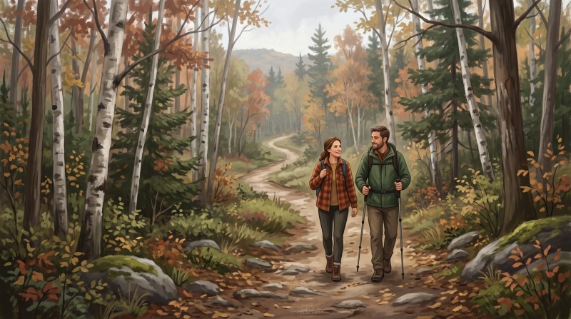
Exploring the backcountry of northern Maine often begins in the rugged terrain of Deboullie Public Lands. From a parking area at the east end of Deboullie Pond, hikers can embark on the 6-mile Deboullie Loop Trail or follow the 4-mile roundtrip Tower Trail past boulder fields to a historic 48-foot fire tower overlooking wilderness ponds. Also starting at the east end of Deboullie Pond, the 5.5-mile Black Mountain Loop Trail follows the Little Black Ponds Trail into mature northern hardwood forests of sugar maple, yellow birch, and American beech, opening to views of Black Pond, Deboullie Mountain, and the Gardner rock slide. These routes connect into a 25.8-mile trail network known for talus rockslides, mountaintop wild blueberries in August, and shaded ice caves where snow endures year-round alongside rare arctic sandwort. Earlier foot paths were laid in the 1960s when a Fort Kent Boy Scouts troop set rocks across the Deboullie rockslide, while AmeriCorps members with the Maine Conservation Corps expanded the routes from 7 to 27 miles starting in 2006. In nearby Township 13, Range 12 WELS, hikers reach the Round Pond Mountain Trail from the eastern shore of Round Pond.
Closer to the county's central valleys, established parks and peaks offer panoramic overlooks. At Aroostook State Park in Presque Isle, a large parking lot along Echo Lake near the 0.5-mile QuaQuaJo Nature Trail provides access to trails ascending North Peak and South Peak of Quaggy Jo Mountain. First secured in 1938 through land donated by local citizens and the Presque Isle Merchants Association, these trails were constructed with assistance from the Works Progress Administration and wind past flowing springs through mixed woodlands home to hawks, owls, foxes, deer, and moose. Just west of Mapleton in Castle Hill, a parking lot on Route 163 marks the start of the Haystack Mountain Trail, a steep ascent over ledge yielding 360-degree views across farmland and forests. To the south, the International Appalachian Trail climbs the summit of Mars Hill Mountain toward viewpoints extending over the Aroostook Valley and into western New Brunswick before proceeding to the border crossing at Fort Fairfield, while the Hedgehog Mountain Trail ascends a south ridge in Winterville Plantation.

Those who prefer gentler footing discover extensive paths across refuges, bogs, and rivers. The Aroostook National Wildlife Refuge in Limestone maintains 13 miles of hiking trails across emergent marshes, vernal pools, and forests inhabited by moose, snowshoe hare, beaver, and Canada lynx. More than seven miles start at the visitor center on Refuge Road, including the 8.7-mile Visitor Center and Bunker trails past former military structures, the 5.0-mile West Gate system looping around Chapman Pond and Greenlaw Brook, and the 3.5-mile East Loring Trail loop. Farther south, the Houlton Riverfront Park and Meduxnekeag River Trail offers 4.6 miles of flat gravel and dirt footpaths along the river, and the Salmon Brook Lake Bog in Perham provides 4.7 miles of walking paths and boardwalks through mature forest. In Fort Kent, a 0.8-mile wooded trail begins at the end of Airport Road and leads to Fish River Falls.
Community stewardship remains vital to hiking and walking in Aroostook County. Former train lines have become public footways, including the 18-mile Aroostook Valley Trail along the 1910 railbed acquired with Land for Maine's Future funding, built with help from AmeriCorps and $400,000 in volunteer labor hours from the Youth Community Action Project, alongside the historic Bangor and Aroostook Railroad corridor in Caribou. Local organizations keep trails thriving, including the volunteer-supported Northern Maine Community Trails in Presque Isle with over 22 miles of singletrack that hosts the annual Nordic Trail Festival, and the Four Seasons Trail Association in Madawaska. From the Caribou High School Track and Trails hosting the annual Walk for Hospice to the summits maintained by the International Appalachian Trail Maine Chapter, northern Maine's footpaths are woven into everyday life.
Where to go: St. John Valley · Central Aroostook · Southern Aroostook · North Woods
Rules, seasons, permits, water levels and weather change. Before you go, check current conditions and requirements with the agency that manages the place you plan to visit.

The facts behind this guide
·
Access (7)
- Aroostook National Wildlife Refuge Visitor Center Trailhead Limestone
- More than seven miles of walking and hiking trails begin directly at the Aroostook National Wildlife Refuge Visitor Center located on Refuge Road in Limestone.[1]
- Black Mountain Loop Trailhead T15 R9 WELS
- Hikers accessing the 5.5-mile Black Mountain Loop Trail in Deboullie Public Lands begin at the east end of Deboullie Pond before proceeding along the Little Black Ponds Trail.[2]
- Deboullie Pond Trailhead Parking T15 R9 WELS
- In the Deboullie Public Lands, the Tower Trail and the 6-mile Deboullie Loop Trail start at a parking area located at the east end of Deboullie Pond.[2]
- Echo Lake Trailhead Parking at Aroostook State Park Presque Isle
- Hikers access trails ascending North Peak and South Peak of Quaggy Jo Mountain from a large parking area located along Echo Lake near the Quaquajo Nature Trail in Aroostook State Park.[3]
- Fish River Falls Trailhead Fort Kent
- Walkers access the 0.8-mile wooded trail leading to Fish River Falls from a trailhead located at the end of Airport Road in Fort Kent.[4]
- Haystack Mountain Trailhead and Parking Castle Hill
- The trailhead for the 0.5-mile trail up Haystack Mountain is accessed via a dedicated parking lot located on Route 163 about 4 miles west of Mapleton in Castle Hill.[5]
- Round Pond Mountain Trailhead Township 13, Range 12 WELS
- The trailhead for the Round Pond Mountain Trail is located on the eastern shore of Round Pond within the Round Pond Public Reserved Land unit in Township 13, Range 12 WELS.[6]
Culture (5)
- Annual Walk for Hospice at Caribou High School Track and Trails Caribou
- The Aroostook Hospice Foundation hosts an annual community Walk for Hospice event on the Caribou High School Track and Trails to support the Aroostook House of Comfort.[7]
- Four Seasons Trail Association Year-Round Trails Madawaska
- The Four Seasons Trail Association in Madawaska maintains an extensive community trail system utilized by the public for hiking and walking in the warmer months and Nordic sports in winter.[8]
- International Appalachian Trail Maine Chapter Community and Events Fort Fairfield
- The International Appalachian Trail Maine Chapter coordinates trail maintenance and events across northern Maine, guiding hikers over Aroostook County summits such as Mars Hill Mountain and through the border crossing at Fort Fairfield.[9]
- Nordic Trail Festival Trail Events Presque Isle
- The annual Nordic Trail Festival held at Northern Maine Community Trails (formerly the Nordic Heritage Center) features community outdoor trail recreation, including trail challenges and hiking on over 22 miles of singletrack trails.[10]
- Northern Maine Community Trails Volunteer Organization Presque Isle
- Northern Maine Community Trails is a volunteer-supported organization in Presque Isle that maintains a public, year-round trail network used for community hiking, running, and Nordic sports.[11]
History (8)
- Aroostook Valley Railroad conversion to public trail Washburn
- The Aroostook Valley Trail follows the former railbed of the Aroostook Valley Railroad, which was established in 1910 and ceased operations in 1996 before being acquired and protected for walking and multi-use recreation.[12]
- Bangor and Aroostook rail corridor acquisition Caribou
- The State of Maine acquired the historic Bangor and Aroostook Railroad corridor with Land for Maine's Future funding to protect it as a public multi-use recreational trail open to walkers and hikers.[13]
- Community volunteer labor on Aroostook rail trail corridor Washburn
- The conversion of abandoned rail lines into walking and multi-use trails was advanced by $400,000 in volunteer labor hours from the Youth Community Action Project alongside AmeriCorps and local recreation groups.[14]
- Establishment of Aroostook State Park trail land Presque Isle
- In 1938, local citizens and the Presque Isle Merchants Association donated 100 acres around Echo Lake and Quoggy Jo Mountain to create Maine's first state park and secure public recreational trails.[15]
- Fort Kent Boy Scouts Deboullie rockslide trail T15 R9 WELS
- In the 1960s, Boy Scouts of America Troop from Fort Kent placed rocks to build one of the earliest foot trails across the Deboullie rockslide.[2]
- Land for Maine's Future protection of Aroostook Valley Trail Washburn
- The Land for Maine's Future program provided grant funding to acquire and protect the abandoned 18-mile Aroostook Valley rail corridor for non-motorized and multi-use trail recreation.[14]
- Maine Conservation Corps Deboullie trail expansion T15 R9 WELS
- AmeriCorps members serving with the Maine Conservation Corps began constructing and rehabilitating hiking routes in Deboullie in 2006, expanding the system from 7 miles to 27 miles.[2]
- WPA construction of Aroostook State Park trails Presque Isle
- Following the donation of 100 acres around Quoggy Jo Mountain in 1938, initial hiking trails, ski trails, and warming shelters were constructed with assistance from the federal Works Progress Administration (WPA).[16]
Nature (8)
- Aroostook National Wildlife Refuge Trail System and Wildlife Limestone
- The refuge maintains 13 miles of designated hiking trails across habitats such as streams, vernal pools, emergent marshes, and upland forests. Hikers can observe boreal birds, waterfowl, moose, snowshoe hare, beaver, and Canada lynx along the routes.[17]
- Aroostook State Park Hiking Trails Wildlife Presque Isle
- Trails climbing Quaggy Jo Mountain traverse mixed spruce, fir, beech, and maple woodlands where walkers regularly see red squirrels and chipmunks, alongside hawks, owls, woodpeckers, foxes, deer, and moose.[18]
- Black Mountain Loop Trail Forest Composition T15 R9 WELS
- The 5.5-mile Black Mountain Loop Trail in the Deboullie Ecological Reserve leads hikers through mature northern hardwood forest dominated by sugar maple, yellow birch, and American beech.[19]
- Deboullie Mountain Late Summer Blueberries T15 R9 WELS
- Hikers ascending Deboullie Mountain can find and pick wild blueberries along the mountaintop trails in August.[20]
- Deboullie Mountain Trail Ice Caves and Arctic Plants T15 R9 WELS
- Hikers on the Deboullie Mountain trail network can locate shaded rock crevices known as ice caves where snow and ice persist year-round, supporting rare cold-climate plants such as arctic sandwort.[20]
- East Loring Trail Wildlife Viewing Limestone
- The 3.5-mile East Loring Trail loop at Aroostook National Wildlife Refuge provides wildlife viewing opportunities for migratory birds, white-tailed deer, river otter, snowshoe hare, and moose.[21]
- QuaQuaJo Nature Trail Flora and Fauna Presque Isle
- The 0.5-mile QuaQuaJo Nature Trail in Aroostook State Park loops through mature forest past flowing springs, offering walkers varied displays of native trees, plants, birds, and small animals.[22]
- Winter Trail Grooming at Aroostook National Wildlife Refuge Limestone
- From November through April, the refuge maintains over seven miles of trails groomed for classic and skate skiing, which also accommodate snowshoers on the ungrooved portions.[23]
Summits and viewpoints (6)
- Black Mountain Loop Trail T15 R9 WELS
- The Black Mountain Loop Trail in Deboullie Public Lands leads hikers across scenic vistas overlooking Black Pond, Deboullie Mountain, and the Gardner rock slide.[24]
- Deboullie Mountain Tower Trail T15 R9 WELS
- The Tower Trail ascends Deboullie Mountain past boulder fields to a historic 48-foot fire tower overlooking surrounding ponds and North Maine Woods wilderness.[24]
- Haystack Mountain Trail Castle Hill
- A short, rugged trail ascends Haystack Mountain to an open summit that provides 360-degree views across Aroostook County farmland and forests.[25]
- Hedgehog Mountain Trail Winterville Plantation
- The Hedgehog Mountain Trail is a footpath leading up the south ridge of Hedgehog Mountain to summit views of the surrounding northern Aroostook landscape.[26]
- Mars Hill Mountain Trail Mars Hill
- A section of the International Appalachian Trail climbs to the summit of Mars Hill Mountain, offering wide viewpoints over the Aroostook Valley and western New Brunswick.[27]
- Quaggy Jo Mountain Summit Trails Presque Isle
- In Aroostook State Park, trails climb Quaggy Jo Mountain to panoramic viewpoints on both its North Peak and South Peak summits.[3]
Trails (8)
- Aroostook National Wildlife Refuge Visitor Center and Bunker Trails Limestone
- The refuge's Visitor Center and Bunker trail network spans 8.7 miles of Level 1 difficulty walking trails past former military structures and wildlife habitats.[1]
- Aroostook National Wildlife Refuge West Gate Trails Limestone
- The West Gate trail system at Aroostook National Wildlife Refuge offers a 5.0-mile network of Level 1 difficulty hiking and walking trails looping around Chapman Pond and Greenlaw Brook.[28]
- Aroostook State Park Hiking Trail Network Presque Isle
- Aroostook State Park features a 2.8-mile hiking trail network ranging from Level 1 to Level 3 in difficulty, ascending the dual peaks of Quaggy Jo Mountain.[3]
- Deboullie Pond Tower Trail T15 R9 WELS
- The Tower Trail in Deboullie Public Reserved Land is a 4-mile roundtrip hike rated moderate to difficult that ascends past rockslides to a 48-foot fire tower on Deboullie Mountain.[2]
- Deboullie Public Reserved Land Hiking System T15 R9 WELS
- Deboullie Public Reserved Land contains a 25.8-mile network of rugged trails ranging from easy to advanced difficulty, known for mountain vistas, talus rockslides, and ice caves.[20]
- Haystack Mountain Trail Castle Hill
- The Haystack Mountain Trail is a 0.4-mile round-trip hiking path rated Level 2 in difficulty, known for its steep ascent over ledge to 360-degree panoramic summit views.[25]
- Houlton Riverfront Park and Meduxnekeag River Trail Houlton
- This 4.6-mile network of Level 1 difficulty trails winds along the banks of the Meduxnekeag River, featuring flat gravel and dirt footpaths suitable for walking and hiking.[29]
- Salmon Brook Lake Bog Hiking Trails Perham
- The Salmon Brook Lake Bog trail network covers 4.7 miles of Level 2 difficulty walking paths and boardwalks through mature forest and an ecological reserve bog.[30]
Sources (30)
- Aroostook National Wildlife Refuge - Visitor Center & Bunker Trails - Maine Trail Finder — mainetrailfinder.com , viewed Oct 9, 2026
- Deboullie Public Land Guide & Map - Maine.gov — maine.gov , viewed Oct 10, 2026
- Aroostook State Park - Hiking Trails - Maine Trail Finder — mainetrailfinder.com , viewed Oct 14, 2026
- Fish River Falls Trail - Maine Tourism Association — mainetourism.com , viewed Oct 14, 2026
- Aroostook State Park Trail Conditions & Activities: Maine DACF — maine.gov , viewed Oct 14, 2026
- Round Pond Public Reserved Land | NRCM - Natural Resources Council of Maine — nrcm.org , viewed Oct 14, 2026
- 4th Annual Walk for Hospice raises over $75000 for the Aroostook House of Comfort — thecounty.me , viewed Oct 14, 2026
- Acadian Landing Day | Visit Aroostook — visitaroostook.com , viewed Oct 14, 2026
- Aroostook Hills Region Management Plan - Maine.gov — maine.gov , viewed Oct 14, 2026
- Nordic Trail Festival | Visit Aroostook — visitaroostook.com , viewed Oct 14, 2026
- About | Northern Maine Community Trails — nmctrails.org , viewed Oct 14, 2026
- Travel the Aroostook Valley Trail - Visit Maine — visitmaine.com , viewed Oct 9, 2026
- Bangor & Aroostook Trail - Land for Maine's Future — landformainesfuture.org , viewed Oct 14, 2026
- Aroostook Valley Trail | NRCM - Natural Resources Council of Maine — nrcm.org , viewed Oct 14, 2026
- State Parks - Central Aroostook Chamber of Commerce — centralaroostookchamber.com , viewed Oct 14, 2026
- Aroostook State Park propelled region's winter recreation - The County — thecounty.me , viewed Oct 14, 2026
- Wildlife watching at Aroostook National Wildlife Refuge | FWS.gov — fws.gov , viewed Oct 10, 2026
- Aroostook State Park - Maine.gov — maine.gov , viewed Oct 10, 2026
- Deboullie Public Reserve Lands - Maine.gov — maine.gov , viewed Oct 14, 2026
- Deboullie Public Reserved Land - Maine Trail Finder — mainetrailfinder.com , viewed Oct 14, 2026
- East Loring Trail - Aroostook National Wildlife Refuge - Maine Tourism Association — visitmaine.net , viewed Oct 14, 2026
- Aroostook State Park - Hiking Trails - Maine Trail Finder — mainetrailfinder.com , viewed Oct 10, 2026
- Aroostook National Wildlife Refuge - Visitor Center & Bunker Trails - Maine Trail Finder — mainetrailfinder.com , viewed Oct 14, 2026
- Deboullie Public Lands - Maine.gov — maine.gov , viewed Oct 14, 2026
- Haystack Mountain Trail (Castle Hill) - Maine Trail Finder — mainetrailfinder.com , viewed Oct 14, 2026
- Hedgehog Mountain Trail (Winterville) - Maine Trail Finder — mainetrailfinder.com , viewed Oct 14, 2026
- Mars Hill Mountain - Maine Trail Finder — mainetrailfinder.com , viewed Oct 9, 2026
- Aroostook National Wildlife Refuge - West Gate Trails - Maine Trail Finder — mainetrailfinder.com , viewed Oct 14, 2026
- Houlton Riverfront Park and Meduxnekeag River Trail - Maine Trail Finder — mainetrailfinder.com , viewed Oct 9, 2026
- Salmon Brook Lake Bog Public Reserved Land - Maine Trail Finder — mainetrailfinder.com , viewed Oct 11, 2026
Last updated October 16, 2026.