Roads, Bridges and Border Crossings
Route 1, the bridges and the border
The roads, bridges, and border crossings of Aroostook County grew out of nineteenth-century frontier boundary disputes between Maine and British North America. Following the establishment of the international river border, early trails and military routes evolved into a network of overland highways and modern international river crossings. Today, historic crossing points and inspection stations continue to shape regional travel along the border.
 Your logo here
This page could be sponsored
Your business name here
Sponsor This Page
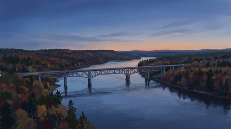
The transportation network across Aroostook County began with urgent frontier security. In response to border tensions leading up to the 1838–1839 Aroostook War, United States soldiers completed the Military Road to Houlton in 1832, connecting Bangor and Mattawamkeag to Hancock Barracks where Lieutenant Robert E. Lee served briefly on a surveying mission. The westerly Aroostook Road cut through Sherman and reached 37 miles north to the banks of the Aroostook River at Masardis by 1833, while surveyor Noah Barker lotted the township around Ashland between 1839 and 1840, linking the Aroostook Road corridor to the Fairbanks Road heading toward Presque Isle. When the Webster-Ashburton Treaty of 1842 resolved the boundary dispute by establishing the Saint John and Saint Francis rivers as the formal international boundary line, new roadways were also cut south along the Fish River to connect valley settlements with interior Maine.
Along the river boundary, international ferries gradually yielded to modern infrastructure, allowing customs officials to channel and monitor cross-border traffic into dedicated checkpoints. An international bridge across the Saint John River between Van Buren and Saint Leonard opened in 1911, replacing earlier cable ferry service, and another span connected Madawaska to Edmundston, New Brunswick, in 1922. At Fort Kent, where cross-border travelers had once depended on ferries, a 1905 toll footbridge, or winter river ice before a 1930 span opened, the new Clair-Fort Kent Bridge over the Saint John River officially opened in July 2014, linking Maine State Route 161 directly with New Brunswick Route 205 as the northern terminus of U.S. Route 1.
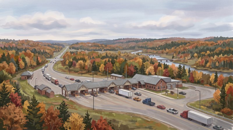
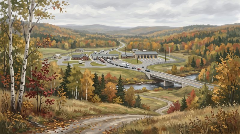
Overland border crossings in Aroostook County expanded alongside dedicated federal oversight. The U.S. Border Patrol established the Houlton Sector on May 28, 1924, placing patrol inspectors at border points including Houlton, Fort Fairfield, Fort Kent, Mars Hill, and Van Buren, while a brick inspection station was constructed on Boundary Line Road in Fort Fairfield in 1933 to monitor traffic from Andover. When Interstate 95 reached the border in the 1970s, international traffic in Houlton shifted from the original two-lane highway crossing to a newly built Interstate Port of Entry facility.
Historic crossings and markers remain embedded throughout the county. In Littleton, the 1911 Watson Settlement Bridge over the Meduxnekeag River stood as Maine's northernmost historic Howe truss covered bridge until destroyed by fire in 2021, while the Little Black River Covered Bridge in Allagash Plantation was dismantled in 1956 as the last wooden covered bridge in Maine deliberately removed for a modern steel and concrete span. Today, travelers can find the August 9, 1842 treaty commemorated by an 1843 cast-iron obelisk at the headwaters of Monument Brook in Amity, a boulder and plaque placed by the DAR at Garrison Hill in Houlton, and a historical marker in Fort Kent that recalls the Military Road's role during the Aroostook War.
Where to go: St. John Valley · Central Aroostook · Southern Aroostook · North Woods
Every fact on this page comes from the sources listed below. Histories are told in many ways, so where sources differ we say so.
The facts behind this history
·
Background and causes (7)
- Aroostook Road extension to Masardis Masardis
- Built during the border dispute period to open transportation into the interior of the territory, the westerly Aroostook Road cut through Sherman and was extended 37 miles north to the banks of the Aroostook River at Masardis by 1833.[1]
- Creation of U.S. Border Patrol Houlton Sector Houlton
- To manage and patrol international transit and border movements across Aroostook County, the U.S. Border Patrol established the Houlton Sector on May 28, 1924, staffing patrol inspectors at border points including Houlton, Fort Fairfield, Fort Kent, Mars Hill, and Van Buren.[2]
- Establishment of the international river border Saint John River
- The Webster-Ashburton Treaty of 1842 resolved the Aroostook War by establishing the Saint John and Saint Francis rivers as the international boundary line, setting the fixed border where subsequent international ferries, bridges, and border crossings were constructed.[3]
- Fish River road following border settlement Fish River
- Following the 1842 border settlement along the Saint John River, new roadways were cut south along the Fish River to connect valley settlements with interior Maine.[3]
- Interstate 95 border crossing diversion at Houlton Houlton
- When Interstate 95 opened to the Canadian border in the 1970s, international traffic in Houlton was diverted away from the original two-lane highway crossing onto the newly constructed Interstate Port of Entry facility.[4]
- Military Road construction to Houlton Houlton
- In response to national security concerns and the brewing northern border dispute with British North America, United States soldiers completed the Military Road to Houlton in 1832 to provide an overland transit route into eastern Aroostook County.[5]
- Road development spurred by the Aroostook War Houlton
- Boundary disputes over unsettled borders established in the 1783 Treaty of Paris culminated in the 1838–1839 Aroostook War, which compelled substantial state and federal investment in roadway systems connecting Aroostook County with the rest of Maine.[5]
Key events and dates (5)
- Completion of the Military Road to Houlton Houlton
- In 1832, United States soldiers completed the construction of the Military Road connecting Bangor to Houlton amid border tensions in northern Maine.[6]
- Construction of Madawaska-Edmundston Bridge Madawaska
- Madawaska was connected across the border to Edmundston, New Brunswick, by the construction of an international bridge in 1922.[7]
- Opening of the New Clair-Fort Kent International Bridge Fort Kent
- A new international bridge across the Saint John River connecting Fort Kent, Maine, with Clair, New Brunswick, officially opened in July 2014, serving as the northern terminus of U.S. Route 1.[8]
- Opening of the Van Buren International Bridge Van Buren
- An international bridge across the St. John River between Van Buren, Maine, and St. Leonard, New Brunswick, opened to traffic in 1911, replacing earlier cable ferry service.[9]
- Settlement of the International Border by Treaty Fort Kent
- The Webster-Ashburton Treaty of 1842 resolved the Aroostook War boundary dispute, establishing the St. John and St. Francis rivers as the formal international border between Maine and New Brunswick.[3]
Legacy today (4)
- Fort Kent Aroostook War Historical Marker Fort Kent
- A historical marker in Fort Kent commemorates the 1839 Aroostook War boundary conflict and notes the role of the Military Road as the primary transportation avenue for troops mobilized during the dispute.[10]
- Garrison Hill Marker at Military Road Terminus Houlton
- A memorial plaque and boulder placed by the Lydia Putnam Chapter of the DAR marks Garrison Hill in Houlton, the post established to guard the disputed border where the historic Military Road connected Bangor to Hancock Barracks.[11]
- Little Black River Covered Bridge Removal Allagash
- Maine Department of Transportation historical records document that the Little Black River Covered Bridge in Allagash Plantation, dismantled in 1956, was the last wooden covered bridge in Maine deliberately removed to make way for a modern steel and concrete span.[12]
- Monument Brook International Boundary Marker Amity
- At the headwaters of Monument Brook on the Maine-New Brunswick border, an 1843 cast-iron obelisk set in concrete commemorates the August 9, 1842 Webster-Ashburton Treaty that established the international boundary line.[13]
People (4)
- Andrew Blaisdell's Geotechnical Work on the Madawaska International Bridge Madawaska
- Andrew Blaisdell, associate principal and geotechnical engineer with GZA, served as an engineer overseeing the implementation of thermal integrity profiling sensors for the foundation piers of the new international bridge between Madawaska and Edmundston.[14]
- Noah Barker's Survey of the Aroostook Road and Fairbanks Road Ashland
- Surveyor Noah Barker lotted the township around Ashland between 1839 and 1840, establishing connections along the Aroostook Road corridor and the Fairbanks Road extending toward Presque Isle.[15]
- Robert E. Lee's Engineering Service on the Military Road at Hancock Barracks Houlton
- Following the construction of the Military Road connecting southern Maine to Houlton, Lieutenant Robert E. Lee served briefly as a military engineer on a surveying mission stationed at Hancock Barracks in Houlton.[16]
- U.S. Soldiers Complete the Military Road to Houlton Houlton
- In response to brewing border tensions that culminated in the Aroostook War, United States soldiers built and completed the Military Road connecting Mattawamkeag to the frontier post at Houlton.[17]
Places (5)
- First Madawaska International Bridge Madawaska
- An international bridge spanning the Saint John River between Madawaska and Edmundston opened to traffic in 1922, replacing an earlier cable ferry and centralizing regional border crossings.[18]
- Fort Fairfield U.S. Inspection Station Fort Fairfield
- Constructed in 1933 on Boundary Line Road, the brick U.S. Border Inspection Station in Fort Fairfield was established to monitor vehicle traffic entering from Andover, New Brunswick, and was listed on the National Register of Historic Places in 2014.[19]
- Fort Kent Northern Terminus of US Route 1 Fort Kent
- The Clair–Fort Kent Bridge across the Saint John River connects New Brunswick Route 205 directly with Maine State Route 161 and marks the northern terminus of U.S. Route 1.[20]
- Military Road Completion to Houlton Houlton
- In 1832, United States soldiers completed the Military Road connecting Bangor to Houlton to support troops and supply transportation during the northern Maine border dispute.[21]
- Watson Settlement Covered Bridge Littleton
- Built in 1911 over the Meduxnekeag River on Framingham Road, the Watson Settlement Bridge was Maine's northernmost historic covered bridge using a Howe truss design until it was destroyed by fire in 2021.[22]
Where to learn more (4)
- Digital Maine Historic Bridges Record on the 1832 Military Road Houlton
- State historic transportation archives record that the 1832 Military Road connecting Bangor to Houlton was constructed by the federal government to meet inland national security and frontier transportation needs leading into Aroostook County.[23]
- Fort Kent Historical Marker on River Crossings to Clair Fort Kent
- Historical marker records in Fort Kent note that before the first vehicular bridge opened to Clair, New Brunswick in 1930, cross-border travelers relied on two ferries, a 1905 toll footbridge (Pont des piétons), or crossing the frozen Saint John River in winter.[24]
- Houlton Museum Archives of Historic Regional Transportation Crossings Houlton
- The Aroostook County Historical and Art Museum archives historic local documentation including National Register records for the Watson Settlement Bridge, an authentic historic covered bridge located within the Houlton area.[25]
- Maine Historical Society Records on Madawaska Border Crossing Bridges Madawaska
- The Maine Historical Society documents that the construction of international bridges across the Saint John River in Madawaska, Van Buren, and Fort Kent enabled U.S. customs officials to channel and monitor cross-border traffic into dedicated checkpoints.[7]
Sources (25)
- Early development in Aroostook County — bangordailynews.com , viewed Oct 16, 2026
- Houlton Sector Maine | U.S. Customs and Border Protection — cbp.gov , viewed Oct 16, 2026
- American-Canadian Boundary - Acadian Culture in Maine — acim.umfk.edu , viewed Oct 16, 2026
- Houlton Border Crossing, Maine - The Center for Land Use Interpretation — clui.org , viewed Oct 16, 2026
- Historic Bridges of Maine: 350 Years of Bridge and Roadway Design 2015 - Digital Maine — digitalmaine.com , viewed Oct 16, 2026
- Early development in Aroostook County — thecounty.me , viewed Oct 16, 2026
- International bridge and border crossing, Madawaska, ca. 1948 - Maine Memory Network — mainememory.net , viewed Oct 16, 2026
- New Clair-Fort Kent International Bridge Officially Opened - Maine.gov — maine.gov , viewed Oct 16, 2026
- International bridge, Van Buren, ca. 1911 - Maine Memory Network — mainememory.net , viewed Oct 16, 2026
- The Aroostook War - The Historical Marker Database — hmdb.org , viewed Oct 16, 2026
- The Garrison | acham - The Houlton Museum — achamcouncil.org , viewed Oct 16, 2026
- Historic Covered Bridges | Maine Department of Transportation — maine.gov , viewed Oct 16, 2026
- Historical trek will locate Maine-N.B. marker - The County — thecounty.me , viewed Oct 16, 2026
- Aroostook's new international bridge named best in North America - Bangor Daily News — vertexaisearch.cloud.google.com , viewed Oct 16, 2026
- Towns in northern Aroostook County: history and early settlers - The Upper St. John River Valley — vertexaisearch.cloud.google.com , viewed Oct 16, 2026
- The Garrison | acham - The Houlton Museum — vertexaisearch.cloud.google.com , viewed Oct 16, 2026
- LEGISLATIVE RECORD - HOUSE, March 12, 2014 - Maine State Legislature — vertexaisearch.cloud.google.com , viewed Oct 16, 2026
- Madawaska port of entry, 1947 - Maine Memory Network — mainememory.net , viewed Oct 16, 2026
- Fort Fairfield–Andover Border Crossing - Wikipedia — en.wikipedia.org , viewed Oct 16, 2026
- Clair–Fort Kent Bridge - Wikipedia — en.wikipedia.org , viewed Oct 16, 2026
- The Garrison | acham - The Houlton Museum — achamuseum.net , viewed Oct 16, 2026
- Watson Settlement Bridge - The Historical Marker Database — hmdb.org , viewed Oct 16, 2026
- Historic Bridges of Maine: 350 Years of Bridge and Roadway Design 2015 - Digital Maine — digitalmaine.com , viewed Oct 16, 2026
- One People in Two Countries / Une Vallée sans frontière - The Historical Marker Database — hmdb.org , viewed Oct 16, 2026
- Local Historical Documents | acham - The Houlton Museum — achamuseum.com , viewed Oct 11, 2026
Last updated October 17, 2026.