The Aroostook War
The 1838-39 border dispute that never became a battle
The Aroostook War was an undeclared and bloodless border conflict sparked by ambiguous boundary wording in the 1783 Treaty of Paris and intense timber competition. Tensions escalated into military mobilizations, fort construction, and the formal creation of Aroostook County in 1839 before the dispute was permanently settled by treaty in 1842.
 Your logo here
This page could be sponsored
Your business name here
Sponsor This Page
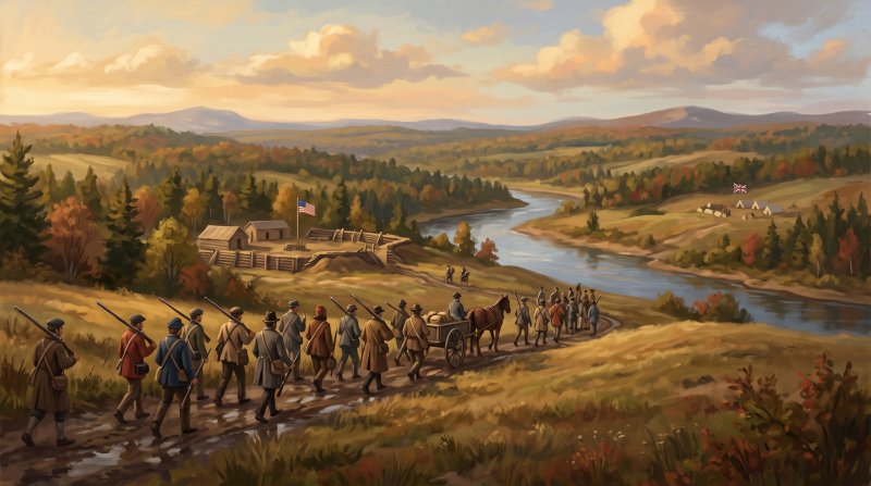
The origins of the border dispute traced back to ambiguous phrasing in the 1783 Treaty of Paris defining the highlands border, which left sovereignty unsettled across the upper Saint John River valley. By the 1820s, competition was surging between American and provincial lumbermen harvesting valuable white pine timber along the Aroostook, Allagash, and Saint John river watersheds. King William of the Netherlands proposed an international compromise boundary along the Saint John and Saint Francis rivers in 1831, but the United States Senate rejected it largely due to fierce opposition from the State of Maine. Tensions sharpened when a census agent sent to enumerate inhabitants along the Saint John River at Madawaska in 1837 was arrested by British authorities and taken to New Brunswick. In late 1838 near Caribou, armed Maine lumbermen confronted New Brunswick lumberjacks; the tense standoff produced gunfire when Canadians shot an attacking black bear, after which both sides dispersed without human combat casualties.
Events escalated rapidly in early 1839, when the Maine Legislature directed Land Agent Rufus McIntire to assemble an armed civil posse and arrest timber trespassers. Sheriff Hastings Strickland traveled up the frozen Aroostook River by sleigh in February to assist McIntire in stopping illegal timber operations. Soon after, McIntire was captured in a home at Fort Fairfield by New Brunswickers. In response, volunteer forces encamped along the Aroostook River to build fortifications to secure the valley, while Ivory Hardison drove a span of horses hauling a wagonload of soldiers northward. On March 5, 1839, Isaac Hodsdon issued orders directing troops to northern Maine to restore order, and the Maine Legislature formally created Aroostook County to reinforce the state's jurisdiction. In Houlton, federal troops stationed at Hancock Barracks on Garrison Hill were tasked with maintaining peace and restraining the Maine militia. Negotiations averted armed military conflict, and during April and May 1839, militia troops were withdrawn, mustered out, and sent home.
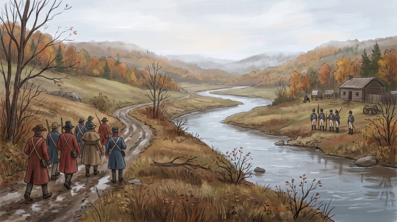
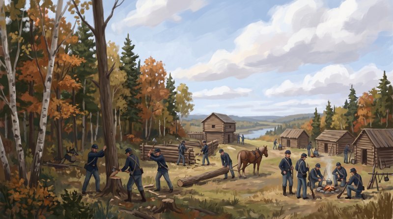
The northern frontier solidified as members of a civil posse commanded by Captain Nye and Captain Stover Rines constructed an outpost of square-hewn cedar logs at the confluence of the Fish and Saint John rivers. Named Fort Kent in honor of Maine Governor Edward Kent, who aggressively advocated for Maine's territorial claims, the post formed the nucleus around which the town of Fort Kent later grew. To the south, the town of Fort Fairfield developed around the works named for Maine Governor John Fairfield, built to keep disputed timber from reaching New Brunswick. The entire border controversy known as the Aroostook War in Aroostook County ended permanently without a battle in 1842 through the Webster-Ashburton Treaty, with an iron obelisk erected in August 1843 at the headwaters of Monument Brook marking the agreed line.
Today, the heritage of the conflict remains visible across northern Maine. Fort Kent State Historic Site preserves the two-story cedar log Fort Kent Blockhouse as a museum and National Historic Landmark, recognized as the only surviving original American fortification from the conflict. In Fort Fairfield, a reconstructed 1976 blockhouse museum maintained by the Frontier Heritage Historical Society features artifacts, documents, and historical presentations explaining the dispute's origins. In Houlton, the Soldiers Cemetery on White Settlement Road holds the graves of soldiers who died while on duty at Hancock Barracks, and Presque Isle's Maysville Museum features a permanent cornerstone exhibit exploring the conflict's local impact.
Where to go: St. John Valley · Central Aroostook · Southern Aroostook
Every fact on this page comes from the sources listed below. Histories are told in many ways, so where sources differ we say so.
The facts behind this history
·
Background and causes (7)
- Arrest of the 1837 Federal Census Taker Madawaska
- Tensions heightened sharply when a census agent sent to enumerate inhabitants along the Saint John River at Madawaska was arrested by British authorities and taken to New Brunswick.[1]
- Creation of Aroostook County Houlton
- Aroostook County was formally created by the Maine Legislature in 1839 during the conflict to reinforce the state's administrative and legal jurisdiction over the disputed northern territory.[2]
- Erection of Fort Fairfield Works Fort Fairfield
- Following the detention of Maine officials in February 1839, Maine volunteer forces and civil posses encamped on the Aroostook River and constructed initial fortifications that became Fort Fairfield to secure the valley against provincial lumber crews.[3]
- Land Agent Rufus McIntire Dispatched to the Aroostook Fort Fairfield
- In January 1839, the Maine Legislature directed Land Agent Rufus McIntire to assemble an armed civil posse and arrest timber trespassers cutting along the Aroostook River.[3]
- Rejection of the 1831 Dutch Arbitration Saint John River
- In 1831, King William of the Netherlands proposed an international compromise boundary along the Saint John and Saint Francis rivers, but the United States Senate rejected it largely due to fierce opposition from the State of Maine.[4]
- Timber Competition along Aroostook Waterways Aroostook River
- Escalating tension in the 1820s was fueled by competition between American and provincial lumbermen harvesting valuable white pine timber along the Aroostook, Allagash, and Saint John river watersheds.[5]
- Treaty of Paris Ambiguity in the Upper Saint John Madawaska
- The boundary dispute originated with ambiguous wording in the 1783 Treaty of Paris defining the highlands border, leaving sovereignty unresolved across the upper Saint John River valley in what is now northern Aroostook County.[6]
Key events and dates (7)
- Battle of Caribou standoff Caribou
- In late 1838, armed Maine lumbermen confronted New Brunswick lumberjacks cutting timber near Caribou. The tense standoff resulted in gunfire when Canadians shot a startled black bear that attacked them, after which both sides dispersed without human combat casualties.[7]
- Construction of Fort Kent Blockhouse Fort Kent
- The Fort Kent blockhouse was constructed in 1839 by the Maine militia at the confluence of the Fish River and the Saint John River to defend the territory against British incursions.[8]
- Creation of Aroostook County Fort Kent
- Aroostook County was created in 1839 out of the border tensions of the Aroostook War as the State of Maine worked to solidify its administrative hold on the disputed region.[9]
- Establishment of Fort Fairfield Fort Fairfield
- Following the deployment of Maine volunteer troops to the Aroostook River in early 1839 to halt unauthorized timber cutting, forces fortified the site and constructed Fort Fairfield.[10]
- Orders for troops to northern Maine Aroostook River
- On March 5, 1839, orders were issued by Isaac Hodsdon directing troops to northern Maine to restore order between Maine and New Brunswick residents amid the border conflict.[8]
- Settlement by the Webster-Ashburton Treaty Fort Kent
- The Aroostook War border dispute ended permanently without a battle in 1842 with the signing of the Webster-Ashburton Treaty, establishing the international boundary between Maine and New Brunswick.[11]
- Withdrawal of militia troops Houlton
- During April and May 1839, after negotiations averted an outbreak of armed military conflict, Maine militia troops were withdrawn from Aroostook County, mustered out, and returned home.[12]
Legacy today (4)
- Aroostook War Historical Marker in Fort Kent Fort Kent
- An official roadside historical marker stands in Fort Kent commemorating the 1839 undeclared and bloodless Aroostook War border conflict.[13]
- Fort Fairfield Blockhouse Museum Replica Fort Fairfield
- Fort Fairfield features a reconstructed blockhouse museum built in 1976 roughly 1,000 feet west of the original site, commemorating the outpost erected during the 1839 Aroostook War.[11]
- Fort Kent State Historic Site Blockhouse Fort Kent
- The two-story cedar log blockhouse in Fort Kent is preserved as a museum and National Historic Landmark, recognized as the only surviving American fortification from the Aroostook War.[14]
- Monument Brook Boundary Marker Amity
- An iron obelisk erected in August 1843 at the headwaters of Monument Brook marks the international boundary established by the Webster-Ashburton Treaty following the Aroostook War.[15]
People (5)
- Civil Posse Established Fort Kent Blockhouse Fort Kent
- Members of a Maine civil posse commanded by Captain Nye and Captain Stover Rines constructed the initial blockhouse post at the confluence of the Fish and Saint John rivers during the conflict.[16]
- Fort Kent Named for Governor Edward Kent Fort Kent
- The military outpost along the Fish River in Aroostook County was named Fort Kent in honor of Maine Governor Edward Kent, who aggressively advocated for Maine's territorial claims.[17]
- Ivory Hardison Transported Troops to Aroostook Fort Fairfield
- Ivory Hardison drove a span of horses hauling a wagonload of soldiers northward to Fort Fairfield in the winter of 1839 during the mobilization of the Aroostook War.[18]
- Rufus McIntire Arrested by Lumbermen Fort Fairfield
- In February 1839, Maine Land Agent Rufus McIntire led a civil posse into the disputed Aroostook Valley to expel unauthorized timber cutters, but he was captured in a home at Fort Fairfield by New Brunswickers.[19]
- Sheriff Hastings Strickland Traveled Aroostook River Aroostook River
- Sheriff Hastings Strickland traveled up the frozen Aroostook River by sleigh in February 1839 to assist Land Agent Rufus McIntire in stopping illegal timber operations.[20]
Places (6)
- Fort Fairfield Blockhouse Replica Fort Fairfield
- A reconstructed blockhouse museum stands on Main Street near the Aroostook River, representing the fort built in 1839 to protect disputed timberlands from being transported into New Brunswick during the Aroostook War.[21]
- Fort Fairfield Naming and Settlement Fort Fairfield
- The town of Fort Fairfield developed around the military post constructed during the 1839 conflict, named in honour of Maine Governor John Fairfield.[22]
- Fort Kent Blockhouse Fort Kent
- The Fort Kent Blockhouse, built of square-hewn cedar logs at the confluence of the Fish and Saint John rivers, is the only original surviving fortification related to the Aroostook War. It is designated a National Historic Landmark and preserved as Fort Kent State Historic Site.[16]
- Hancock Barracks Houlton
- Established on Garrison Hill in Houlton in 1828, Hancock Barracks was an active U.S. Army post that housed federal troops tasked with maintaining peace and restraining the Maine militia during the Aroostook War crisis.[23]
- Naming of the Town of Fort Kent Fort Kent
- The town of Fort Kent grew around the military installation established during the border conflict and was named after Maine Governor Edward Kent.[24]
- Soldiers Cemetery at Hancock Barracks Houlton
- Located on White Settlement Road in Houlton, the Soldiers Cemetery contains the graves of soldiers who died while on duty at Hancock Barracks during the period surrounding the Aroostook War.[25]
Where to learn more (5)
- Fort Fairfield Blockhouse Museum Fort Fairfield
- Fort Fairfield features a 1976 replica of the 1839 Aroostook War blockhouse, which is maintained as a museum by the Frontier Heritage Historical Society.[26]
- Fort Kent Blockhouse Museum Fort Kent
- The Fort Kent Blockhouse, built in 1839 during the border dispute known as the Aroostook War, is the only surviving original American fortification from that conflict and now operates as a museum.[27]
- Fort Kent Historical Society Founding Project Fort Kent
- When the Fort Kent Historical Society formed in 1925, its first restoration initiative was the town's 1839 blockhouse built during the Aroostook War border dispute.[28]
- Frontier Heritage Historical Society Artifacts Fort Fairfield
- The Frontier Heritage Historical Society displays artifacts, documents, and historical presentations explaining the origins of the 1839 Aroostook War inside the Fort Fairfield Blockhouse.[26]
- Maysville Museum Aroostook War Exhibit Presque Isle
- The Presque Isle Historical Society's Maysville Museum features a permanent cornerstone exhibit specifically dedicated to the Aroostook War and its local impact.[29]
Sources (29)
- The Aroostook War - Maine - National Guard — me.ng.mil , viewed Oct 16, 2026
- Aroostook War | Maine Atlas Project — maine.gov , viewed Oct 16, 2026
- Aroostook War | The Canadian Encyclopedia — thecanadianencyclopedia.ca , viewed Oct 16, 2026
- Aroostook War | Maine State Library Research — maine.gov , viewed Oct 16, 2026
- The Aroostook War and the Northeast Border - Maine Memory Network — mainememory.net , viewed Oct 16, 2026
- American-Canadian Boundary - Acadian Culture in Maine — acim.umfk.edu , viewed Oct 16, 2026
- The Aroostook War: How Maine Got Its Northern Crown | Down East Magazine — downeast.com , viewed Oct 16, 2026
- The Aroostook War - Maine Memory Network — mainememory.net , viewed Oct 16, 2026
- Aroostook War | Maine Atlas Project — maine.gov , viewed Oct 16, 2026
- The Aroostook War, from a History Writer in Maine - johnwood1946 - WordPress.com — johnwood1946.wordpress.com , viewed Oct 16, 2026
- Tour the Blockhouses of a Bloodless War | Visit Aroostook — visitaroostook.com , viewed Oct 16, 2026
- The Aroostook War - Maine - National Guard — me.ng.mil , viewed Oct 16, 2026
- The Aroostook War - The Historical Marker Database — hmdb.org , viewed Oct 16, 2026
- Fort Kent Blockhouse - Maine Acadian Culture (U.S. National Park Service) — nps.gov , viewed Oct 16, 2026
- Historical trek will locate Maine-N.B. marker - The County — thecounty.me , viewed Oct 16, 2026
- Fort Kent Blockhouse - Maine Acadian Culture (U.S. National Park Service) — nps.gov , viewed Oct 16, 2026
- Fort Kent State Historic Site - Maine Tourism Association — mainetourism.com , viewed Oct 16, 2026
- Towns in northern Aroostook County: history and early settlers - The Upper St. John River Valley — upperstjohn.com , viewed Oct 16, 2026
- 'This is my authority': The war that got New Brunswick a border 180 years ago | CBC News — cbc.ca , viewed Oct 16, 2026
- The First Shots Fired in the Aroostook War — aroostookhistory.me , viewed Oct 16, 2026
- Fort Fairfield Blockhouse | Visit Aroostook — visitaroostook.com , viewed Oct 9, 2026
- About Fort Fairfield — fortfairfield.org , viewed Oct 16, 2026
- Hancock Barracks - Wikipedia — en.wikipedia.org , viewed Oct 16, 2026
- Fort Kent - Undiscovered Maine — umaine.edu , viewed Oct 16, 2026
- Soldiers Cemetery Hancock Barracks | acham - The Houlton Museum — houltonmuseum.net , viewed Oct 16, 2026
- Fort Fairfield Blockhouse Museum — fortfairfield.org , viewed Oct 16, 2026
- Fort Kent Blockhouse - Maine Acadian Culture (U.S. National Park Service) — nps.gov , viewed Oct 14, 2026
- Fort Kent Historical Society turning 100 this year - The County — thecounty.me , viewed Oct 9, 2026
- The Maysville Museum | National Trust for Historic Preservation — savingplaces.org , viewed Oct 16, 2026

Last updated October 16, 2026.