The Allagash and the North Woods
River history, wilderness and sporting camps
The Allagash Wilderness Waterway preserves a historic water corridor winding through the North Woods to where the river joins the St. John River in Aroostook County. Along its lakes, rapids, and forest shores, centuries of log driving, traditional sporting camps, and deep wilderness heritage remain rooted in the land.
 Your logo here
This page could be sponsored
Your business name here
Sponsor This Page
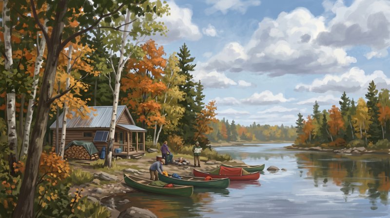
The northern stretch of the Allagash Wilderness Waterway reaches deep into northern Aroostook County, where the river completes its journey to meet the St. John River. Long before modern recreation, this wilderness water corridor moved heavy timber northward with spring freshets, supported by dams and improvements built by 19th-century lumber companies. Lumberman William Cunliffe ran Cunliffe Depot on the river's east bank as a headquarters and supply base until the 1930s, leaving behind the remnants of two Lombard log haulers. Drivers like Sam Jalbert directed crews floating logs downstream, while Jean-Baptiste Jalbert navigated logging towboats out of Michaud Farm, an 1870s settlement that later served as a logging depot and a Waterway ranger station. Travelers on the lower river still encounter Allagash Falls, a historic drop of thirty to forty feet that presented a major obstacle to timber drives and requires a portage today.
Along these shores, homesteads and sporting outposts grew into community touchstones. In Township 15, Range 11 WELS, George and Lucinda Moir settled in the mid-19th century, where Thomas Moir constructed a hay barn around 1874 to sustain woodsmen and river travelers. Nearby, north of Michaud Farm, former game warden and guide Henry Taylor and his wife Alice built three log sporting camps during the 1930s, which the State of Maine preserves today. Upstream at Round Pond in Township 13, Range 12 WELS, Willard Jalbert Sr., known as 'The Old Guide,' built a camp at Windy Point in 1941. By 1965, his family operated camps across Round Pond, Burntland Brook, and Whittaker Brook, welcoming guests whose vintage records now rest at the Acadian Archives at the University of Maine at Fort Kent.
When hydroelectric projects like the proposed Dickey-Lincoln dam threatened to flood the river valley during the 1960s, protection became urgent. The Maine Legislature officially established the waterway in 1966, backed by a voter-approved $1.5 million bond that Aroostook County residents supported by a tally of 21,709 to 19,530. Rather than dismantling traditional camps like Jalbert's on Round Pond, the state acquired and leased them back to maintain shelter, safety, and longstanding traditions. In 1970, the corridor became the first state-administered component of the National Wild and Scenic Rivers System. Today, downriver in Allagash on Dickey Road, the Allagash Historical Society Museum exhibits early farming, river driving, and lumbering tools, preserving the lasting frontier legacy of the North Woods.
Where to go: St. John Valley
Every fact on this page comes from the sources listed below. Histories are told in many ways, so where sources differ we say so.
The facts behind this history
·
Background and causes (5)
- Aroostook County Referendum Approval Allagash River
- Maine voters approved a $1.5 million bond referendum in November 1966 to acquire the shoreline corridor and protect the wilderness character of the Allagash, with Aroostook County voters passing the measure by a vote of 21,709 to 19,530.[1]
- Establishment of the Allagash Wilderness Waterway Allagash River
- The Maine Legislature established the Allagash Wilderness Waterway in 1966 to preserve and protect the wilderness character of the 92-mile water corridor, including the river's northern reach through Aroostook County. In 1970, it became the first state-administered component of the National Wild and Scenic Rivers System.[2]
- Logging Infrastructure and Water Control Allagash River
- Log drives northward down the Aroostook County section of the Allagash River to the St. John River basin historically depended on a network of dams and river improvements built by 19th-century timber companies to manage water flow into late spring.[3]
- Opposition to Proposed St. John Basin Dams Allagash
- Efforts to protect the Allagash gained urgency in the 1960s to prevent proposed hydroelectric developments like the Dickey-Lincoln project near the mouth of the Allagash River, which threatened to inundate thousands of acres of north woods river valley.[1]
- Preservation of Traditional Sporting Camps Round Pond
- When the State of Maine acquired the Allagash corridor, established sporting camps such as Jalbert's Camps on Round Pond in Aroostook County were retained rather than dismantled because they represented traditional public recreation and provided safety on the waterway.[4]
Key events and dates (7)
- Construction of Henry Taylor Camps Allagash River
- Former Allagash game warden and guide Henry Taylor and his wife Alice built three log sporting camps along the Allagash River in Aroostook County during the 1930s, whose remnants still stand.[4]
- Construction of Johns Bridge for Logging T13 R12 WELS
- Between 1969 and 1970, Canadian logging contractors Denis and Gilles Poulin rebuilt and named Johns Bridge between Round Pond and Churchill Lake in Aroostook County to haul timber and connect forest road networks.[4]
- Establishment of Cunliffe Depot Allagash River
- Lumberman William Cunliffe established Cunliffe Depot on the banks of the Allagash River in Aroostook County during the late 1800s, operating a major logging supply and headquarters base there until the 1930s.[5]
- Jalbert's Sporting Camps Operation Round Pond
- By 1965, brothers Robert and Willard Jalbert Jr. operated eight sporting camp buildings in Aroostook County along the waterway, including five at Round Pond, two at Burntland Brook, and one at Whittaker Brook.[4]
- Legislative Creation of Allagash Wilderness Waterway Allagash Wilderness Waterway
- In 1966, the Maine Legislature officially established the Allagash Wilderness Waterway to protect and preserve the wilderness character of the watercourse, including its stretch flowing through Aroostook County.[6]
- National Wild and Scenic River Designation Allagash River
- In 1970, the Allagash Wilderness Waterway was designated as the first state-administered component of the National Wild and Scenic Rivers System, covering the river corridor through Aroostook County.[7]
- Waterway Logging Artifact Survey Allagash Wilderness Waterway
- In 1994, the Maine Bureau of Parks and Lands launched an inventory across the Allagash Wilderness Waterway that surveyed and recorded historical machinery, engines, and structures left by early 20th-century logging operations.[4]
Legacy today (5)
- Allagash Historical Society Museum Collection Allagash
- The Allagash Historical Society operates a museum on Dickey Road in Allagash that preserves and interprets local logging history, St. John River log drives, and early frontier settlement heritage.[8]
- Historic Taylor Camps north of Michaud Farm Allagash River
- The State of Maine owns and maintains the historic, vacant Taylor's Camps located along the Allagash River north of Michaud Farm in Aroostook County as part of the waterway's preserved human history.[9]
- Jalbert Camps Guest Records Preservation Fort Kent
- Vintage guest records from the Jalbert Camps on Round Pond along the Allagash Wilderness Waterway were copied and archived at the Acadian Archives at the University of Maine at Fort Kent.[10]
- Jalbert's Sporting Camps on Round Pond T13 R12 WELS
- Within Aroostook County's portion of the Allagash Wilderness Waterway in T13 R12 WELS, the State of Maine owns and leases the historic Jalbert's Sporting Camps on Round Pond, providing traditional sporting camp accommodations.[9]
- Logging and Cultural Displays at Allagash Museum Allagash
- The Allagash Historical Society Museum exhibits tools and artifacts representing lumbering, farming, and community settlement in the North Woods of northern Maine.[11]
People (5)
- Henry and Alice Taylor Camps Allagash River
- Former Allagash game warden and guide Henry Taylor and his wife Alice built and occupied three log camps along the Allagash River in the 1930s, the remnants of which are still known as the Henry Taylor Camps.[4]
- Jean-Baptiste Jalbert at Michaud Farm Michaud Farm
- Jean-Baptiste Jalbert operated logging towboats along the northern Allagash River, supporting operations based around the historic Michaud Farm settlement in northern Aroostook County.[12]
- Sam Jalbert and Allagash River Drives Allagash River
- Renowned Allagash guide Sam Jalbert served as a foreman on seasonal river drives, directing log-driving crews that floated timber down the Allagash and St. John rivers during spring freshets.[13]
- Thomas Moir Settlement on the Allagash T15 R11 WELS
- Thomas Moir established a river farmstead along the lower Allagash River in Township 15, Range 11 WELS, which served as a frontier base supporting woodsmen and river travelers.[14]
- Willard Jalbert Sr. and Round Pond Sporting Camps T13 R12 WELS
- Guide and woodsman Willard Jalbert Sr., known as 'The Old Guide,' built his first sporting camp at Windy Point on Round Pond in Township 13, Range 12 WELS in 1941, establishing Jalbert's Sporting Camps which were later leased back to his family after state acquisition.[15]
Places (7)
- Allagash Falls Landmark and Portage T15 R10 WELS
- Dropping roughly 30 to 40 feet along the lower Allagash River in northern Aroostook County, Allagash Falls was a historic obstacle during log drives and remains a notable landmark requiring a portage for river travelers.[16]
- Cunliffe Depot Logging Camp and Relics T14 R11 WELS
- Cunliffe Depot served as lumberman William Cunliffe's base camp on the east bank of the Allagash River in northern Aroostook County until the 1930s, and the site preserves the remains of two Lombard log haulers.[5]
- Establishment of the Allagash Wilderness Waterway Allagash
- Established by the Maine Legislature in 1966, the Allagash Wilderness Waterway protects a 92.5-mile corridor that terminates in northern Aroostook County where the Allagash River joins the St. John River.[4]
- Henry Taylor Camps T15 R11 WELS
- Built in the 1930s by former Allagash game warden and guide Henry Taylor and his wife Alice on the banks of the Allagash River in Aroostook County, the remains of three log sporting camps still stand within the waterway.[4]
- Michaud Farm Logging Depot and Settlement T15 R11 WELS
- Settled as far back as the 1870s along the Allagash River in Aroostook County, Michaud Farm served in the 1920s and 1930s as a logging base camp and traveler depot before becoming a key Waterway ranger station.[4]
- Moir Farmstead Historic Structures T15 R11 WELS
- Established by George and Lucinda Moir in the mid-19th century downstream from Michaud Farm in Aroostook County, the site retains a historic hay barn constructed around 1874 by Thomas Moir behind the Taylor Camps.[17]
- Willard Jalbert Sporting Camps T13 R12 WELS
- Located on Round Pond in Township 13, Range 12 WELS in Aroostook County, the camps were built in 1941 by guide Willard Jalbert Sr. and were later acquired by the state of Maine while remaining under lease to the family.[18]
Where to learn more (6)
- Allagash Historical Society Founding and Mission Allagash
- Founded in 1975 to preserve local history, the society maintains collections of lumbering equipment, archival river-drive photographs, and records from the Scots-Irish settlers of the Allagash region.[19]
- Allagash Historical Society Museum Allagash
- The Allagash Historical Society operates a museum on Dickey Road in Allagash that preserves and interprets local logging, river-driving, and farming history along the Allagash and St. John rivers.[20]
- Allagash Sporting Camp Archives at UMFK Fort Kent
- In 2019, vintage sporting camp guest records from the Jalbert Camps on Round Pond within the Allagash Wilderness Waterway were copied and deposited in the Acadian Archives at the University of Maine at Fort Kent.[21]
- Allagash Wilderness Waterway Interpretive Plan and Heritage Assessment Allagash Wilderness Waterway
- The comprehensive heritage resource study 'Storied Lands & Waters of the Allagash Wilderness Waterway' documents cultural, sporting camp, and logging resources across the waterway to guide preservation efforts.[22]
- Fort Kent Historical Society Lumbering Heritage Exhibits Fort Kent
- Housed in a historic 1902 railroad station, the Fort Kent Historical Society curates artifacts and exhibits focusing on the agricultural and lumbering history of the surrounding North Woods.[23]
- Lower Allagash Natural History Guide Publication Allagash
- The Maine Department of Conservation and Bureau of Parks and Lands published a specialized natural history guide by Sheila and Dean Bennett detailing the ecology and features of the lower Allagash River below Allagash Falls in Aroostook County.[24]
Sources (24)
- Explore Maine: Protecting the Allagash | NRCM — nrcm.org , viewed Oct 16, 2026
- Allagash River | Rivers.gov - U.S. Fish and Wildlife Service — rivers.gov , viewed Oct 16, 2026
- Lock Dam: History: Discover History & Explore Nature: State Parks and Public Lands: Maine ACF - Maine.gov — maine.gov , viewed Oct 16, 2026
- Allagash History: Parks and Public Lands: Maine DACF — maine.gov , viewed Oct 10, 2026
- The legend of Joe Mckiel and Cunliffe Depot - Bangor Daily News — bangordailynews.com , viewed Oct 16, 2026
- Allagash Wilderness Waterway, a Maine - State Parks — stateparks.com , viewed Oct 16, 2026
- Allagash River | Rivers.gov - U.S. Fish and Wildlife Service — rivers.gov , viewed Oct 10, 2026
- Sites - Maine Acadian Heritage Council — images.squarespace-cdn.com , viewed Oct 16, 2026
- Allagash Wilderness Waterway - Maine.gov — maine.gov , viewed Oct 16, 2026
- Storied Lands & Waters (SLW) - Allagash Wilderness Waterway Foundation — awwf.org , viewed Oct 16, 2026
- Allagash Historical Society | SOS - Maine.gov — maine.gov , viewed Oct 16, 2026
- Maine's Dirty Little Culture War - Greg Jalbert — gregjalbert.ghost.io , viewed Oct 16, 2026
- Woods Work - Acadian Culture in Maine — acim.umfk.edu , viewed Oct 16, 2026
- Storied Lands & Waters of the Allagash Wilderness Waterway: Interpretive Plan and Heritage Resource Assessment - Digital Maine — digitalmaine.com , viewed Oct 16, 2026
- Willard Jalbert Camps on the Land Conservation Assistance Network — landcan.org , viewed Oct 16, 2026
- Allagash Wilderness Waterway - Maine.gov — maine.gov , viewed Oct 10, 2026
- The Moir Farm part of rich Allagash history - Bangor Daily News — bangordailynews.com , viewed Oct 16, 2026
- Willard Jalbert Camps are an Allagash institution - Bangor Daily News — bangordailynews.com , viewed Oct 16, 2026
- Allagash Historical Society - Maine Memory Network — mainememory.net , viewed Oct 16, 2026
- Allagash Historical Society | SOS - Maine.gov — maine.gov , viewed Oct 16, 2026
- Storied Lands & Waters Report - Allagash Wilderness Waterway Foundation — awwf.org , viewed Oct 16, 2026
- Allagash Wilderness Waterway Foundation | Maine State Library — digitalmaine.com , viewed Oct 16, 2026
- Fort Kent Historical Society - Maine Memory Network — mainememory.net , viewed Oct 16, 2026
- Allagash Wilderness Waterway A Natural History Guide - Maine.gov — maine.gov , viewed Oct 16, 2026


Last updated October 17, 2026.